
Basin size 448 km (173 sq mi) | Length 36 km | |
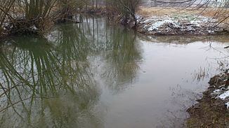 | ||
River mouth in the Franconian Saale near Bad Neustadt230 m (750 ft) | ||
The Streu is a river of Bavaria, Germany. It arises in the north of Franconia by the Thuringian border, below the Ellenbogen mountain just north of Fladungen. It flows southeast for about 25 km through Ostheim to Mellrichstadt, then flows southwest for another 10 km to join the Franconian Saale at Heustreu near Bad Neustadt. From Fladungen to Mellrichstadt the Streu proceed through a valley, 2–4 km wide, between low hills. This region is known locally as the Streutal.
Map of Streu, Germany
The Streu is too small and shallow for navigation but its lower reaches below Mellrichstadt are suitable for light boating and kayaking. The Streu occasionally floods, especially in spring when the snow melts on the Rhön Mountains. These floods are not generally destructive in the Streutal, but can contribute to more serious flooding downstream on the Franconian Saale.