
Admin. region Unterfranken Municipal assoc. Ostheim vor der Rhön Local time Monday 6:43 PM | Elevation 300 m (1,000 ft) Population 3,518 (31 Dec 2008) | |
 | ||
Weather 17°C, Wind SE at 11 km/h, 25% Humidity Points of interest Kirchenburg Ostheim, Orgelbaumuseum Ostheim vor der R, Ruine Lichtenburg, Ostheimer Warte | ||
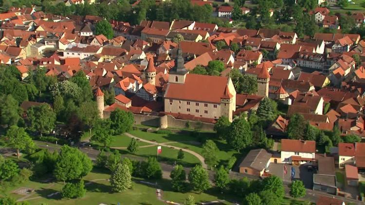
Ostheim vor der Rhön is a town in Northern Bavaria in the district of Rhön-Grabfeld in Franconia. Though politically part of Bavaria since 1947, it was historically a part of Thuringia, and remains religiously, architecturally, and to some extent culturally distinct from its immediate surroundings.
Contents
Map of Ostheim, Germany
History
Ostheim was first mentioned in 804. During the Reformation, Ostheim (along with much of the surrounding region) became Protestant. However, in the 1580s and 1590s, a powerful Counter-Reformation effort led by Julius Echter von Mespelbrunn, the Prince-Bishop of Wurzburg, reconverted most of the Streutal (the Streu valley, in northern Franconia) back to Catholicism. Ostheim and a few villages nearby became Protestant islands in a solidly Catholic region. (The town's heavily fortified Lutheran church dates from this period.) Ostheim was sacked by Imperial troops in 1634 during the Thirty Years War, but survived and retained its distinctive character. From the 17th century until 1920 the town was an exclave of Protestant Saxe-Weimar-Eisenach, first in Catholic Franconia and then in Bavaria after Franconia came under the Bavarian crown. After the First World War, it became an exclave of Thuringia in Bavaria from 1920 until 1947.
During the late 19th and early 20th century, as religious differences faded in importance, the town became increasingly integrated into the surrounding region, becoming a small regional industrial center as well as a market for the surrounding agricultural hinterland. In 1945 Ostheim became part of the American controlled zone, in the Free State of Bavaria. In 1947 it was formally transferred to Bavarian control in exchange for some similar exclaves in the Soviet Zone.
Ostheim lies on the river Streu between Mellrichstadt and Fladungen. It is one of the stops in Wim Wenders' 1976 road trip film Kings of the Road.
The gunmaking company Herbert Schmidt Ostheim (also: HS - Herbert Schmidt Waffentechnik) was based in Ostheim. It is also the home of German soft drink manufacturer Bionade. Ostheim's historic architecture, walkable town center and easy access to the biking and hiking trails of the Streu valley have helped make it a local center for tourism.