
Population 244 (2011 census) LGA(s) Gundagai Council Postal code 2725 | Postcode(s) 2725 Elevation 303 m Local time Tuesday 7:58 PM | |
 | ||
Location 388 km (241 mi) SW of Sydney102 km (63 mi) NE of Wagga Wagga22 km (14 mi) NW of Cootamundra34 km (21 mi) E of Temora Weather 19°C, Wind W at 8 km/h, 41% Humidity | ||
Stockinbingal fire
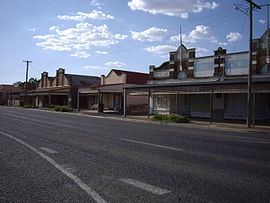
Stockinbingal is a town in the South West Slopes and Riverina regions of New South Wales, Australia. The town is in the Gundagai Council local government area and on the Burley Griffin Way. At the 2011 census, Stockinbingal had a population of 244.
Contents
Map of Stockinbingal NSW 2725, Australia
Stockinbingal Post Office opened on 16 May 1891.
Stockinbingal 48s hd
Railways
It is the location of a railway junction connecting the Cootamundra to Lake Cargelligo railway line (completed to Stockinbingal in 1893) to Parkes, which provides an alternative route from Sydney to Parkes to the route over the Blue Mountains, avoiding that route's steep grades and is now as a result the major route for freight between Sydney and Perth. The route from Cootamundra to Stockinbingal and Parkes is also part of a rail bypass of Sydney for traffic between Melbourne and Brisbane via Dubbo, Werris Creek and Maitland.