
Population 1,380 (2011 census) Postal code 2672 | Postcode(s) 2672 Local time Saturday 9:41 PM | |
 | ||
Weather 25°C, Wind NE at 8 km/h, 25% Humidity University Riverina Institute, Lake Cargelligo | ||
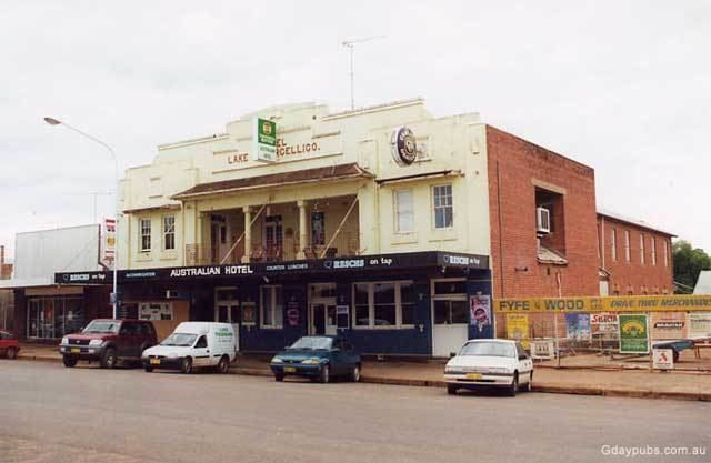
Lake Cargelligo (/ˌleɪk kɑːrˈdʒɛlᵻɡoʊ/, locally [ˌlæɪk kaːˈdʒeləɡəʉ]) is a town in the Central West region of New South Wales, Australia, on Lake Cargelligo. It is in Lachlan Shire. At the 2011 census, Lake Cargelligo had a population of 1,380 people. Its name is said to be a corruption of the Aboriginal word 'Kartjellakoo' meaning 'he had a coolamon'. A coolamon is a shallow wooden dish. Alternatively it is derived from Wiradhuri and Ngiyambaa "gajal" for water container with suffix "lugu" for "her" or "his".‹See TfD› In 2011 it had an indigenous population of 236 (17.1%) and an Australian born population of 1,241 (89.7%).
Contents
- Map of Lake Cargelligo NSW 2672 Australia
- History
- Transport
- Mining
- Solar Thermal Power Station
- The lake
- References
Map of Lake Cargelligo NSW 2672, Australia
History
The explorers, John Oxley and George Evans, followed the Lachlan River down to Lake Cargelligo in 1817. Lake Cargelligo was known as Cudgelligo (or sometimes Cudgellico) in the 1800s and was officially changed when the railway arrived in 1917.
Transport
The railway from Cootamundra to Wyalong was extended to Lake Cargelligo in 1917. The railway station opened as 'Cargelligo' in 1917 and was renamed 'Lake Cargelligo' in 1919. Rail-motor passenger services operated to the town until 1983. Since then the railway link has been used for cargo transport, especially for bulk grain which the surrounding farms cultivate. It also has a strong World War I background and ANZAC heritage.
Mining
Rich mineral deposites are found in the area around the township. Mines include:
Solar Thermal Power Station
Lake Cargelligo is the site of the Lake Cargelligo Thermal Power Station, a concentrated Solar Thermal Power station.
The plant uses dual axes sun tracking mirrors (heliostats) to reflect solar energy onto central towers to heat up multiple graphite solar storage receivers. The heat is then used to generate electricity via a 3MWe steam turbine generator, related steam cycle plant and controls.
The 620 heliostats have a combined reflective surface area of 6 080 m².
The plant was constructed using a grant from the Australian Government's Advanced Electricity Storage Technologies (AEST) Program. The plant commenced operation in May 2011. More details on the project can be obtained from the Final Public Report – Commonwealth of Australia Department of Resource, Energy and Tourism, August 2011.
By of 2014, the operator had accumulated more than 25,000 hours of operating data from the solar power plant.
In 2016, the owner announced plans to dismantle the Lake Cargelligo site for redevelopment. The new site will be used for research and development as well as for demonstration purposes. Construction of the new site is set to begin early 2017.
The lake
As its name would suggest, the town of Lake Cargelligo is situated on a lake fed by the Lachlan River through Lake Curlew. The lake was originally named Regent's Lake by the explorer John Oxley after the prince regent of England at the time. The lake was the primary water source for the early mining town, and has continued to remain an integral source of water for Lake Cargelligo's inhabitants and for all users along the lower Lachlan. These days the lake serves recreational uses as well, bird watchers are by far the largest group of visitors to the lake and surrounds due to the incredible diversity of waterfowl and other rare birds in the district. Boating, fishing and water skiing, also contribute to the town's tourism industry.
After many years of drought, it was reported in early 2010 that the lake ran dry for the first time since 1902.