
Country Austria Vehicle registration KI Elevation 381 m Population 2,014 (1 Apr 2009) Postal code 4594 | Time zone CET (UTC+1) Website www.steinbachsteyr.at Area 28.2 km² Local time Monday 9:05 AM Area code 07257 | |
 | ||
Weather 2°C, Wind NE at 5 km/h, 74% Humidity | ||
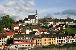
Steinbach an der Steyr is a municipality in the district of Kirchdorf an der Krems in the Austrian state of Upper Austria.
Contents
- Map of 4596 Steinbach an der Steyr Austria
- Geography and geology
- Emblem
- History
- Places of interest
- Sports
- Events
- Traffic
- Economy
- Public buildings
- Schools
- References
Map of 4596 Steinbach an der Steyr, Austria
Geography and geology
Steinbach is in the valley of the river Steyr. It is on 381 metres over sea level. It is 20 kilometres south of the town Steyr. 36,0% of its area is wood, 53,7% of the area is used for agriculture. The highest hill is the Hochbuchberg with 1273 metres. The nearby lodge Grünburger Hütte is on 1080 metres. The community area is divided in the four subparts Steinbach, Pieslwang, Forstau and Zehetner. The neighbour communities are Grünburg, Ternberg, Aschach an der Steyr, Waldneukirchen and Molln.
The river Steyr on the west side of the community is embedded in deep carved gravel terraces with few sand banks. The canyon is mostly natural finished, the water is quality is excellent. Its cold temperature of maximal 16 degrees and strong currents make the shallow river dangerous at several sections.
Emblem
The emblem of Steinbach is a jewelled golden crown in front of blue background. Two crossed rapiers and a standing sword are plotted through the crown. The colors of the community are blue and yellow.
History
In the 11th century the area was part of Styria under Ottokar I of Steyr. A tower or a castle was built on the top of a slope beside the Steyr. At the end of the 12th century the area became part of the dukedom of Austria under the Babenbergers. The castle was not needed anymore and its stones were used for a church for the growing village. A staircase and a farm still reflect the castle in their names. Old stories mention a tunnel between the castle and a second building.
The village contained farms and handicraft enterprises. The farmers were bondsmen. They had to give the tenth part of their harvest to the owners of the farm. The name Zehetner reflects this till today. The handicraft enterprises used water power to work with iron. The metal was brought over the nearby river Enns from Styria. The handicraft enterprises lasted until the 1960s. The community emblem was originally the emblem of the craftsmen. They were named "Messerer". Some old buildings on the riverside still show the emblem. Today a small power plant and a museum also mark their elapsed working place.
Places of interest
Sports
Events
Traffic
Economy
Enterprises