
Local time Monday 12:59 AM | ||
 | ||
Weather 5°C, Wind NE at 13 km/h, 94% Humidity | ||
Stavoren starum friesland frysl n the netherlands in the mist walking and cycling gopro
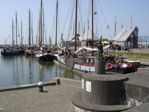
Stavoren, ['staːvərə(n)] previously Staveren (West Frisian: Starum) is a small town on the coast of the IJsselmeer, about 5 km south of Hindeloopen.
Contents
- Stavoren starum friesland frysl n the netherlands in the mist walking and cycling gopro
- Map of Stavoren Netherlands
- Overview
- References
Map of Stavoren, Netherlands
Overview
The historical Stavoren was granted city rights between 1060 and 1067, making it the oldest city in Friesland. It is mentioned in early texts as the burial place of the early kings of Friesland, including the first Christian king Adgil II (d. 730), who was a son of Radbod/Redbad, the last pagan king who lived from about 670 to 719 AD.
Stavoren began to decline in the late Middle Ages after a sandbank formed outside the harbour, blocking ships from entering and exiting. The appearance of the sandbank is the topic of the Dutch Renaissance folk-tale of the Lady of Stavoren. In 1657, the entire town was submerged in a great flood.
Modern Stavoren is a village with a population of less than 1000 within the municipality of Súdwest-Fryslân. It is one of the stops on the Elfstedentocht, (literally, 'eleven cities tour'), an ice skating contest/event which occurs when the winter temperatures provide safe conditions.
A ferry for pedestrians and cyclists operates between Stavoren and Enkhuizen, with increased trips during summer months.