
- summer (DST) CEST (UTC+2) Area 50.94 km² | Elevation 279 m Local time Sunday 3:23 PM | |
 | ||
Weather 10°C, Wind N at 19 km/h, 35% Humidity | ||
Triatlon star tur 2013
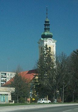
Stará Turá (German: Alt-Turn, Hungarian: Ótura) is a town in the Trenčín Region in western Slovakia.
Contents
Map of Star%C3%A1 Tur%C3%A1, Slovakia
Geography
It is located in the Myjava Hills close to the Little Carpathians as well as the White Carpathians. It is situated 11 km (6.84 mi) from Nové Mesto nad Váhom to the west, 12 km (7.46 mi) from Myjava to the east and around 99 km (61.52 mi) from Bratislava to the north and has a population of 9,172 (2014) with an area of 50,942 km2 (19,668.82 sq mi).
History
The first written record about Stará Turá was in 1392, as a village belonging to the Čachtice Castle. It was part of it until feudalism ceased to exist in the Austro-Hungarian Empire, the Kingdom of Hungary.
In 1467, Matthias Corvinus promoted Stará Turá to the servile town (oppidum), boosting the town's economy. In 1848, the town was nearly destroyed by fire.
Demographics
According to the 2001 census, the town had 10,291 inhabitants. 97.4% of inhabitants were Slovaks, 1.7% Czechs and 0.2% Roma. The religious make-up was 45.5% Lutherans, 27.3% Roman Catholics and 23.6% people with no religious affiliation.