Nové Mesto nad Váhom (German: Neustadt an der Waag, Neustadtl, Waag-Neustadtl, Waagneustadtl, Waag-Neustadt; Hungarian: Vágújhely, Vág-Újhely) is a town in the Trenčín Region of Slovakia.
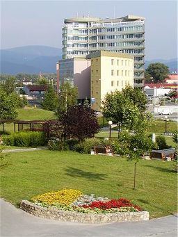
District town located at the northern edge of the Danubian Hills at the foothills of the northern end of the White Carpathians, on the Váh river. Other mountains nearby are the White Carpathians and the Považský Inovec. It is situated 27 km from Trenčín and 100 km from Bratislava and has a population of 21,629 (1996) with an area of 32.583 km². the Town parts: Mnešice, Izbice, Javorinaská, Hájovky, Samoty, Luka, Centrum, Rajková (northern city), Záhumenice.
Zelená voda Lakes 1 km - watersports, windurfing, fishing, sports centre, camping area, disco and music festival placeČachtice Castle 6 km - home of Elizabeth BáthoryBeckov Castle 5 km -Tematin Castle 12 kmthe most famous Slovak Spa town Piešťany 18 kmTrenčín 22 kmVeľká Javorina Mountain (SK-CZ border) 15 kmSki Resort Kálnica 7 kmDucové - the Great Moravian Empire settlement 16 kmRomanesque church in Haluzice 12 kmLands in the place of today's Nové Mesto nad Váhom were inhabited in the prehistoric ages, as many artefacts from the Stone and Bronze Ages were discovered. In the local part Mnešice a prehistoric settlement was discovered.
The first written record about Nové Mesto nad Váhom was in 1263, when King Béla IV of Hungary granted freedoms for the loyalty during the Mongol invasions. It belonged to the Benedictine order, later to Matthew III Csák and others. It received its town privileges in 1550. Industry developed in the 19th century and was mainly focused at processing agricultural products.
Fortified Roman-Reneissance-Baroque Church of Virgin MaryRenaissance Vicariage BuildingRenaissance church fortificationRenaissance-Baroque Ghillanys´ Palace (17th Century)Renaissance Nadasdys´ Palace (16th Century)Protestant Church (1787)St. Ondrej Church (1643)Baroque Chapel in Hurbanova St. (18th Century)Baroque St. Rochus Chapel (18th Century)Plague Memorial on the main square (1696)St. Florian Statue (1762)According to the 2001 census, the town had 21,327 inhabitants. 98.1% of inhabitants were Slovaks, 1.1% Czechs 0.6% Roma. The religious make-up was 56% Roman Catholics, 23.3% people with no religious affiliation, and 13.8% Lutherans.
Stibor of Stiboricz (ca. 1348–1414) and his wife the Dutchess Dobrochnathe Duke Ctibor II.David ben Menachem Mandel Deutsch (1760–1830), rabbi, TalmudistEde Horn (German: Eduard Horn), born Ignacz Einhorn (1825–1875), a Hungarian Jewish economist, politicianLeopold Donath (1845–1876), rabbiSalomon Stricker (1834–1898), Jewish pathologistErnest Nagel (1901–1985), philosopher of scienceJela Špitková (born 1947); (de)Anička Jurkovičová - the 1st Slovak actressJakub HaškoĽudmila PodjavorinskáPeter Matejka - artist, painterMarkovič brothers - politiciansDominik Štubňa Zámostský - novelistrailway - the town lies on the most important trans-Slovak railway joining Bratislava and Kosice and the local railways branch joins Nové Mesto nad Váhom with Veselí na Moravě in the Czech Republic; EXPRESS TRAIN SERVICE from the train station - Bratislava-Kosice every 1-2h frequency, regional trains to Bratislava, Žilina, Veselí na Moravě aprx. 10 times a dayroad - main motorway D1 Bratislava - Zilina, local roads to Piešťany Spa, Trenčín, Stará Turá, Strání (SK-CZ border)public transport in the town - the blue local busses stop at all the stops in the town area; public transport bus service RED BUS line 1 (Hajovky-Centrum-Railway station/Bus station - Industrial zone/MILEX) and line 2 (Railway station/Bus station - Centrum - Mnešice)buses - the blue local buses "SAD" join the town with all the villages in the Nove Mesto district; the bus station is just right at the train station about 10 mins walking from the town centre; long-haul bus services join the town with all the important towns is Slovakia and Czech Republicairport - the nearest airport Piešťany Spa Airport (PZY); Bratislava M.R. Stefanik Airport (BTS) (100 km southwest, 55min. drive by motorway D1)TAXI service - TAXI stand at Railway Station/Bus station; or on request by phoneNové Mesto nad Váhom twinned with:
Nové Mestá Európy (European "New Towns")