
Population 231 Civil parish Stainforth Sovereign state United Kingdom | OS grid reference SD821673 Local time Saturday 3:47 PM District Craven | |
 | ||
Weather 16°C, Wind E at 11 km/h, 27% Humidity | ||
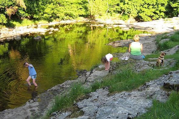
Stainforth is a village and civil parish in the Craven district of North Yorkshire, England. It is situated very near Settle; only about 1 mile north there is a waterfall, Stainforth Force, where the river falls over limestone ledges into a deep, broad pool which can be accessed by walking a short way from the village. There was a Youth Hostel at Taitlands between 1942 and 2007.
Contents
Map of Stainforth, UK
History
Its name derives from the 'stony ford' which linked two settlements half a mile apart on opposite banks of the River Ribble north of Settle. Stainforth, on the eastern side, was formerly owned by Sawley Abbey, whose monks developed the estate which prospered, while Little Stainforth, under private ownership, declined. In the 1670s, Samuel Watson replaced the ford by a packhorse bridge whose arch spans a wooded stretch of the river, and a grassy patch leads downstream to Stainforth Force. In Little Stainforth the three-storey Stainforth Hall was built at the same time and is now occupied as a farmhouse.