
Admin. region Tübingen Elevation 502 m (1,647 ft) Area 17.74 km² Local time Saturday 4:32 PM Dialling code 07346 | District Alb-Donau-Kreis Time zone CET/CEST (UTC+1/+2) Population 3,181 (31 Dec 2008) Postal code 89195 Administrative region Tübingen | |
 | ||
Weather 14°C, Wind NE at 26 km/h, 44% Humidity | ||
Staig is a municipality in the district of Alb-Donau in Baden-Württemberg in Germany. The community belongs to the Gemeindeverwaltungsverband-Kirchberg Weihungstal with headquarter in Illerkirchberg.
Contents
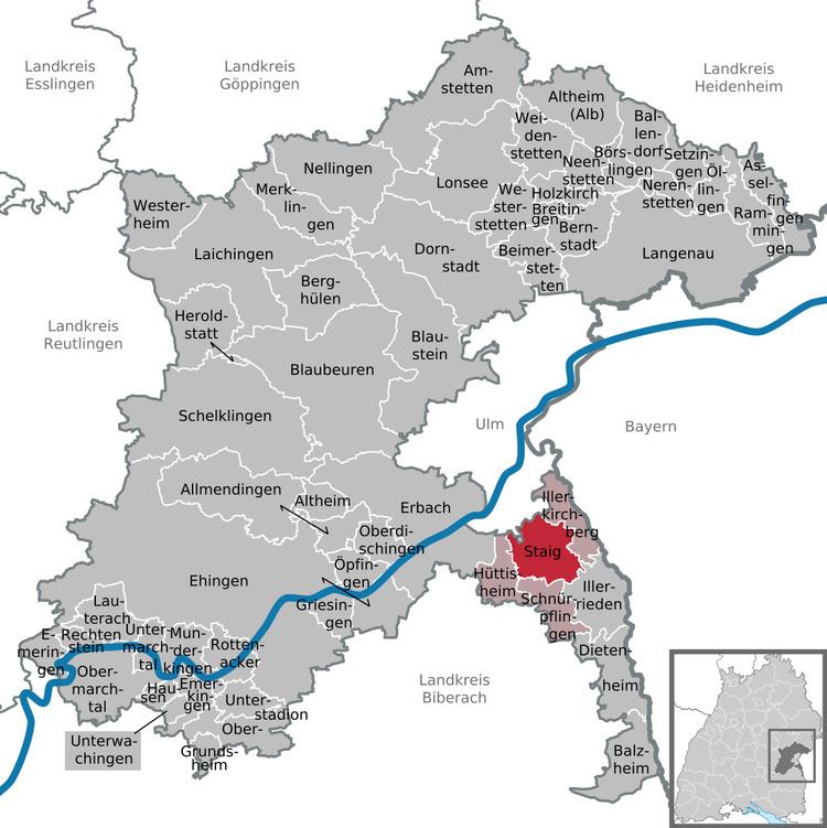
Map of Staig, Germany
Geography
Staig is located on the plateau between the Danube and Iller south of Ulm. The districts Steinberg and Altheim lying on the ridge of both sides of Weihung valley. The other districts are in the valley of the Weihungon or in a side valley. The community thus belongs to the landscape of the Holzstöcke.
Neighboring communities
The municipality is borderinf to the north to district Unterweiler of Ulm, on the east to Illerkirchberg, in the southeast to Illerrieden, on the south to Schnürpflingen and on the west to Hüttisheim .
Municipality arrangement
The municipality Staig consists of the six districts Altheim, Essendorf, Harthausen, Staig, Steinberg and Weinstetten.
History
Staig was first mentioned as "Steiga" in 1127, Altheim followed in 1194. The eldest district however is Harthausen, which appeared in a document already 1093. The other districts followed in the 14th century. On April 1, 1972, the municipality Steinberg was amalgamated with Weinstetten, which was renamed on October 9, 1972, in Staig.