
 | ||
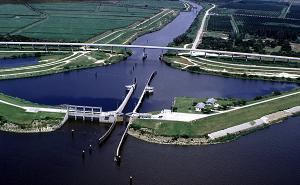
The Okeechobee Waterway or Okeechobee Canal is a relatively shallow man-made waterway stretching across Florida from Fort Myers on the west coast to Stuart on the east coast of Florida. The waterway can support tows such as barges or private vessels up to 50 feet (15 m) wide x 250 feet (75 m) long which draw less than 10 feet (3.0 m), as parts of the system, especially the locks may have low water depths of just ten feet. The system of channels runs through Lake Okeechobee and consists of the Caloosahatchee River to the west of the lake and the St. Lucie Canal (C-44) east of the lake.
Contents
- Map of Okeechobee Waterway Florida 33471 USA
- History
- Management
- St Lucie Lock and Dam
- Port Mayaca Lock and Dam
- Ortona Lock and Dam
- Moore Haven Lock and Dam
- WP Franklin Lock and Dam
- References
Map of Okeechobee Waterway, Florida 33471, USA
A downloadable map of the Okeechobee Waterway can be found by clicking here. Geologically and geographically, the north bank of the canal is the official southern limit of the Eastern Continental Divide.
History
It was built/finished in 1937 to provide a water route across Florida, allowing boats to pass east–west across the state rather than traveling the long route around the southern end of the state.
Management
Lake Okeechobee and the Okeechobee Waterway Project is part of the complex water management system known as the Central and Southern Florida Flood Control Project. The projects cover 16,000 square miles starting just south of Orlando and extending southward through the Kissimmee River Basin to the Everglades National Park to Florida Bay.
The U.S. Army Corps of Engineers manages 5 locks and dams along the Okeechobee Waterway.
St. Lucie Lock and Dam
The St. Lucie lock was built in 1941 for navigation and flood control purposes. In 1944, the connecting spillway structure was built for flood and regulatory flow control through the St. Lucie Canal to manage the water level in Lake Okeechobee.
Port Mayaca Lock and Dam
The Port Mayaca Lock was built in 1977 for navigation purposes, to permit the raising of water levels in Lake Okeechobee, and to moderate the effects of higher lake stages along the St. Lucie Canal (C-44).
Ortona Lock and Dam
The Ortona Lock and Dam were constructed in 1937 for navigation purposes.
Moore Haven Lock and Dam
The Moore Haven Lock and Dam were constructed in 1935 for navigation and flood control purposes.
W.P. Franklin Lock and Dam
The W.P. Franklin Lock and Dam were constructed in 1965 for flood control, water control, prevention of salt-water intrusion, and navigation purposes.