
Population 15,558 (2011 census) Postcode(s) 2075 Founded 1823 | Established 1823 Area 14.39 km² Postal code 2075 | |
 | ||
Location 18 km (11 mi) north of Sydney CBD | ||
St Ives is a suburb on the Upper North Shore of Sydney in the state of New South Wales, Australia 18 kilometres north of the Sydney Central Business District in the local government area of Ku-ring-gai Council. St Ives Chase is a separate suburb, to the north.
Contents
- Map of St Ives NSW 2075 Australia
- History
- Commercial area
- Schools
- Sport and recreation
- Population
- Notable residents
- References
Map of St. Ives NSW 2075, Australia
History
The St Ives area was first explored by Governor Arthur Phillip and a party of men in 1788 where they set up a campsite at Bungaroo which is close to what is now Hunter Avenue. The area produced a small scale timber felling industry. There are still some examples of the thirty metre and higher trees in nearby Pymble in the Dalrymple Hay forest and near Canisius College. Native turpentine trees were also once abundant and provided useful timber for cabinet making. It was once known for its apple orchards but due to residential demand, there is no longer any commercial fruit growing in the area. During World War II there were significant numbers of troops barracked in the area, which provided the impetus to build Archbold Road as a supplementary and emergency route to the city. Since 1950 the suburb has expanded from the central shopping areas and the arterial main roads to include hilltop and valley areas bordering on the surrounding Ku-ring-gai Chase National Park to the north, now the area known as St Ives Chase, and Garigal National Park to the east and the south east.
St Ives Post Office opened on 10 November 1885 and the first public school opened on 6 May 1889. The school was formally opened by Mr. J. P. Burns, M.L.A. on Saturday 8 June. After inspecting the "neat and well-designed school and teacher's residence" the party had a luncheon to mark the occasion.
St Ives was initially slow to develop due to the perceived remoteness from the city. Settlement increased in the late 1890s, when St Ives was populated by market gardeners, a small dairy, orchard workers and related industries. The suburb since the end of WW2 has seen its most rapid period of expansion and a steady growth in families moving to the area.
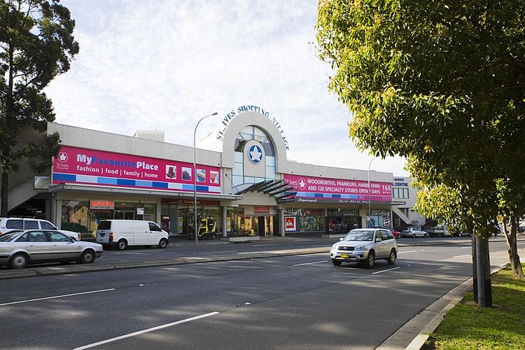
Commercial area
St Ives Shopping Village is a medium-sized shopping centre opened in the 1960s. The centre has over 110 stores, its main tenants are Harris Farm Markets, Romeo's Supa IGA and Woolworths.
Village Green is a popular park in St Ives. Village Green is directly opposite of St Ives Shopping Village.The park is bordered on three streets, Memorial Avenue, Village Green Parade and Cowan Road. The park includes sporting fields, baseball fields, tennis courts and a skate park.
Schools
Sport and recreation
Population
At the 2011 census, St Ives recorded a population of 15,558. Of these:
Of occupied private dwellings in St Ives, 78.8% were separate houses, 6.0% were semi-detached (row or terrace houses, townhouses etc.), 15.1% were flats, units or apartments.