
Area 200 ha Local time Friday 11:32 AM | Population 7,290 (2006) | |
 | ||
Weather 16°C, Wind NE at 5 km/h, 87% Humidity | ||
St Albans is one of Christchurch, New Zealand's largest suburbs. It is a short walk from the central city. To the east of St Albans is Shirley and to the west is Merivale. The suburb is inside the Christchurch Central electorate and is represented by Nicky Wagner, who has been the MP since the 2011 election.
Contents
- Map of St Albans Christchurch New Zealand
- History
- Boundaries
- Community facilities
- St Albans Neighbourhood News
- Earthquake damage
- Notable residents
- References
Map of St Albans, Christchurch, New Zealand
History
Originally a working-class settlement, it was a separate borough from 1881 until 1903 when it became part of Christchurch City. St Albans was named after George Dickinson’s farm, which lay to the south of the St Albans Creek. He had called his farm ‘St Albans’ in memory of his cousin Harriet Mellon, an actress, who had become the Duchess of St Albans.
Boundaries
The St Albans boundaries are: Papanui Road in the west, Mays Road to the north, Cranford Street in the east, and Bealey Avenue to the south.
Community facilities
St Albans centers on the Edgeware shopping centre on Edgeware Road which contains a small number of well-supported shops. A large number of the shops are out of action or were demolished in the aftermath of the Christchurch earthquakes. The suburb contains two schools, St Albans Primary School and St Albans Catholic School. The two main parks in the suburb are St Albans Park and Malvern Park. There is also a small football stadium called English Park.
St Albans Neighbourhood News
St Albans is known for its sense of cohesiveness and community spirit. This has manifested itself in the local monthly paper, The St Albans Neighbourhood News (STANN) http://stalbans.gen.nz/ was first published by a group of local residents in 1993 and is still going to this day. It has a distribution of 5000 homes and businesses and has recently expanded to fill 16 pages. Over the years it has been central in numerous community related issues including local planning, Packe Street Park, the Edgeware Road Tragedy and the closure of Edgeware swimming pool of which it was editorially opposed. The community has now regained control of the pool site and the pool will now be rebuilt with a generous donation from a local resident.
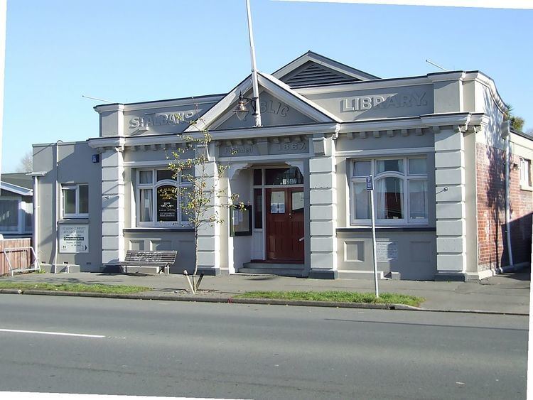
Earthquake damage
The suburb was not significantly damaged in the 2010 Canterbury earthquake. Lots of chimneys came down but only few complete houses. In the 22 February 2011 earthquake the suburb was hit hard. Many houses, supermarkets, and shops were significantly damaged with a lot ending in total demolition. In July 2011, the demolition of the former library, which houses the community centre, was ordered by the Canterbury Earthquake Recovery Authority. In 2014, the extent of the damage to drainage systems and lowered ground levels has become apparent, with the regular flooding of a series of streets known as the Flockton Basin.