
PIN 530011 | Time zone IST (UTC+5:30) Vehicle registration AP 31 and AP 33 | |
 | ||
Government body | ||
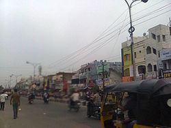
Sriharipuram (Telugu:శ్రీహరిపురం ) is one of the commercial and residential localities in the city of Visakhapatnam, India.
Contents
Map of Sriharipuram, Visakhapatnam, Andhra Pradesh
About
Sriharipuram is a residential area in Visakhapatnam. Thus area is lying South in Visakhapatnam. Mostly middle-class people are living here. There are lot of specialties in sriharipuram. like 24x7 electricity, municipal waterlines, two VUDA apporved parks, a plenty of workout stations, playgrounds, play stations, around 40–50 schools; with great repetition four govt. body schools, hospitals, 24x7 medical stores, one of the greatest hospital with great history St. Anns hospital which controls by a foreigners. thousands of people are living there with a great prosperity in the city of destiny. World's best climate condition. Faster growing place with fast culture pupils.
Localities
Ex-Service men Colony, Pavanaputra Nagar, Ajanta Colony, Ram Nagar, Burma Colony, Jawhar Nagar, Indira colony, Coromandal, Jantha colony, Bala Ganapathi Street, Muralidhar ka ghar, Industrial colony, Acchinaidu tota and Sriramnagar are the main residential areas in Sriharipuram.
Hindustan Petroleum Corporation Ltd., Coromandel, Zinc Smelter, Hindustan Shipyard Ltd.
Transport
Sriharipuram is well connected to Gajuwaka, NAD X Road, Maddilapalem and Pendurthi.