
Country India Headquarters Visakhapatnam Vehicle registration AP-31 Area 11,161 km² Major highway National Highway 16 | State Andhra Pradesh Tehsils 43 Major highways NH-5 Literacy 67.7% | |
 | ||
Colleges and Universities Gandhi Institute of Technology and Management Lok sabha constituencies Araku, Anakapalli, Visakhapatnam Points of interest Kailasagiri, Simhachalam Temple, Indira Gandhi Zoologica, Sivaji Park, INS Kursura (S20) Destinations Visakhapatnam, Araku Valley, Lambasingi, Paderu, Borra Caves | ||
Visakhapatnam district is a district in the Indian state of Andhra Pradesh. It is one of the nine coastal districts in the state, with the administrative headquarters located at Visakhapatnam.
Contents
- Map of Vishakhapatnam Andhra Pradesh
- History
- Demographics
- Geography
- Economy
- Divisions
- Mandals
- Politics
- Transport
- Culture
- Tourist spots
- Education
- References
Map of Vishakhapatnam, Andhra Pradesh
History
Buddhist era
Visakhapatnam history goes back to the 6th century BCE. Its name can be found in Hindu and Buddhist texts that date back to ancient times. Vizag, as Visakhapatnam is often referred to, has been mentioned by Panini and Katyayana in their writings of the fourth century BC. The city was also a part of the Kalinga kingdom, which was later conquered by the emperor Ashoka. Visakha District is a large Buddhist remnants hub with many sites documented and undocumented from north to south border of the district along the coast line.
After independence
In 1979, part of the district was split to help form Vizianagaram district. Visakhapatnam District is currently a part of the Red Corridor.
Demographics
According to the 2011 census Visakhapatnam district has a population of 4,288,113 This gives it a ranking of 44th in India (out of a total of 640) and 4th in its state. The district has a population density of 384 inhabitants per square kilometre (990/sq mi) . Its population growth rate over the decade 2001-2011 was 11.89%. Visakhapatnam has a sex ratio of 1003 females for every 1000 males, and a literacy rate of 67.7%.
Visakhapatnam district has a population of 4,288,113 people of which 57.95% is urban as of 2011 census.
Geography
Visakhapatnam district occupies an area of approximately 11,161 square kilometres (4,309 sq mi), comparatively equivalent to Canada's Cape Breton Island.
Climate
Economy
Visakhapatnam district is the central hub for industry and education in the state of Andhra Pradesh. Visakhapatnam district hosts the Vizag Steel Plant.
AMTZ
Andhra Pradesh Medtech Zone Limited, is the India's first Ultra Modern Medical Equipment Manufacturing & Testing Facility, open to Manufacturers & Innovators.Government of Andhra Pradesh has developed 270 acres of land for this project.The zone will provide for certain capital intensive facilities required by most medical device manufacturers and modern state of art 75-100 independent manufacturing units, each of a built-in ready to use area of 1 to 2 acres.
Household indicators
In 2007–2008, the International Institute for Population Sciences interviewed 1,233 households in 30 villages across the district. They found that 82.1% had access to electricity, 73.9% had drinking water, 42.6% toilet facilities, and 43.8% lived in a pucca (permanent) home. 22.6% of girls wed before the legal age of 18 and 73.8% of interviewees carried a BPL card.
Divisions
The district has four revenue divisions, namely Anakapalli, Paderu, Narsipatnam and Visakhapatnam, each headed by a sub collector. These revenue divisions are divided into 43 mandals in the district. These district consists of 3265 villages and 15 towns including, 1 municipal corporation, 2 municipalities and 12 census towns. Visakhapatnam city is the only municipal corporation and the 3 municipalities in the district are Anakapalle, Bheemunipatnam and Narsipatnam. The 12 census towns are Bowluvada, Chodavaram, Chintapalle, Gudivada, Kantabamsuguda, Mulakuddu, Nakkapalle, Narsipatnam, Peda Boddepalle, Payakaraopeta, Upper Sileru Project Site Camp, Yelamanchili.
Mandals
There are 10 mandals in Visakhapatnam division, 11 each in Narsipatnam, Anakapalle and Paderu divisions. The 43 mandals under their revenue divisions are listed below:
Politics
There are three parliamentary and 15 assembly constituencies in Visakhapatnam district. The parliamentary constituencies are Anakapalli, Visakhapatnam and Araku. The assembly constituencies are Anakapalle, Bhimli, Chodavaram, Yelamanchili, Madugula, Narsipatnam, Paderu, Pendurthi, Payakaraopet, Araku Valley, Visakhapatnam East, Visakhapatnam West, Visakhapatnam North, Visakhapatnam South and Gajuwaka.
Transport
The total of core road network of the district is 945.443 km (587.471 mi). It includes, 298.783 km (185.655 mi) of existing and a proposed length of 646.660 km (401.816 mi).
Culture
Every December, from the third Friday to Sunday, an exclusive three-day festival brings to life the arts, crafts, culture and cuisine of Visakhapatnam.
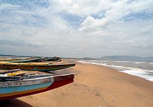
Tourist spots
Education
The primary and secondary school education is imparted by government, aided and private schools, under the School Education Department of the state. They include, 162 government, 2,793 mandal and zilla parishads, 9 residential, 1225 private, 5 model, 34 Kasturba Gandhi Balika Vidyalaya (KGBV), 147 municipal and 829 other types of schools. The total number of students enrolled in primary, upper primary and high schools of the district are 609,587.