
- summer (DST) CEST (UTC+2) Area 64.04 km² | Elevation 469 m | |
 | ||
Spišský Hrhov is a municipality and village in the Spiš region of Slovakia, between Levoča and Spišské Podhradie in Levoča District. Its population is over 1000.
Contents
Map of 053 02 Spi%C5%A1sk%C3%BD Hrhov, Slovakia
History
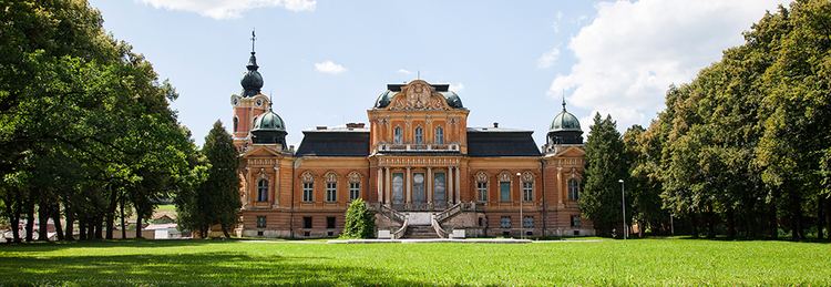
The region contains Neolithic remains, but the earliest written reference to Spišský Hrhov dates from 1243. Originally there were two neighbouring villages named Hrhov, one Slovak and one German. The village became the property of the Čáki (Csáky) family in the 19th century, and their Neo-Baroque manor house still exists (currently abandoned). German village had been known under the name Gorgau.
The village, which is renowned for its crafts, contains the picturesque Early Gothic church of St. Simon and St. Jude. There is also a substantial mediaeval stone bridge, one of the few survivors of its type.
Geography
The municipality lies at an elevation of 475 metres and covers an area of 12.222 km².