
Population 3,321 (2011 census) Spencer Park Seppings Postal code 6330 | Postcode(s) 6330 Area 230 ha | |
 | ||
Location 2.5 km (2 mi) from Albany | ||
Spencer Park is a north-eastern suburb of Albany in southern Western Australia north-northeast of Albany's central business district. Its local government area is the City of Albany, and the suburb was gazetted in 1954.
Contents
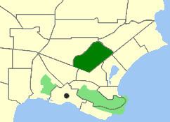
Map of Spencer Park WA 6330, Australia
Geography
The suburb, named after Albany's first Government Resident Sir Richard Spencer RN and gazetted in 1954, is bounded by Ulster Road to the west and north, Collingwood Road to the southeast and North Road to the south. There are two housing estates in Spencer Park. Woodrise And Breaksea Estate. Woodrise is located in the southwest corner and Breaksea Estate is located in the northeast corner
Facilities
Spencer Park contains a shopping centre, fuel station, a retirement home and the Albany Regional Hospital, as well as two schools: St Joseph's College, a Catholic school and a public primary school, Spencer Park Primary School. Spencer Park has a median age of 43.