
Population 845 (2011) Civil parish South Walsham Area 11.43 km² | OS grid reference TG364130 Sovereign state United Kingdom Local time Tuesday 7:16 AM | |
 | ||
Weather 3°C, Wind W at 2 km/h, 96% Humidity | ||
South Walsham is a village and civil parish in the English county of Norfolk. It is adjacent to South Walsham Broad. It covers an area of 11.43 km2 (4.41 sq mi) and had a population of 738 in 303 households at the 2001 census. increasing to 845 living in 345 households at the 2011 Census. For the purposes of local government, it falls within the district of Broadland.
Map of South Walsham, Norwich, UK
The village has a Primary School, started in Victorian times and extensively modified since. The school has close links to the Christian Churches in South Walsham and the neighbouring village of Upton.
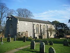
The St Lawrence Centre for Training and the Arts is a restored church which hosts various music concerts, art exhibitions, craft fairs and charity events.
References
South Walsham Wikipedia(Text) CC BY-SA