
State California Incorporated January 20, 1923 Time zone PST (UTC-8) Zip code 90280 Population 95,677 (2013) | County Los Angeles Elevation 115 ft (35 m) Area 19.04 km² Local time Monday 5:14 PM | |
 | ||
Country United States of America Weather 22°C, Wind W at 23 km/h, 35% Humidity | ||
South Gate is the seventeenth largest city in Los Angeles County, California, with 7.4 square miles (19 km2). South Gate is located 7 miles (11 km) southeast of Downtown Los Angeles. It is part of the Gateway Cities region of southeastern Los Angeles County.
Contents
- Map of South Gate CA USA
- Native Americans
- Exploration
- Land grants
- Tracts
- Tweedy family
- Naming
- Geography
- Climate
- 2010
- 2000
- Religion
- Demographics history
- Economy
- Government
- Local government
- City Clerk
- City Treasurer
- City Manager
- Political parties
- Scandal and corruption
- Finances
- County representation
- Roads
- Buses
- City parks
- Education
- Public schools
- Los Angeles Unified School District
- Private schools
- Continuation schools
- Colleges and universities
- Public libraries
- Notable people
- References
Map of South Gate, CA, USA
As of the 2010 census, the city had a population of 94,396.
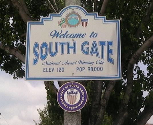
The city was incorporated on January 20, 1923, and it became known as the "Azalea City" when it adopted the flower as its symbol in 1965.
In 1990, South Gate was one of ten U.S. communities to receive the All-America City Award from the National Civic League.
Native Americans
The South Gate area was inhabited by the Gabrielino/Tongva Indians before development by Spanish ranchers.
Exploration
In the summer of 1769, a group of Spanish explorers set out from the coast of San Diego to explore the uncharted territory between San Diego and the Bay of Monterey. With them was Father Juan Crespi, considered by historians to be one of the great diarists of the New World explorations. His daily entries were remarkably revealing of the country through which the caravan passed. The explorers proceeded in the general direction of the San Gabriel Valley, across the Los Angeles River, which Crespi named "Porciuncula" on August 2, 1769.
Land grants
Among the early Spanish settlers was one of California’s first families, the Lugos. The Lugo land grant encompassed a great part of what is now the City of South Gate.
While Francisco Lugo was stationed at Mission San Antonio de Padua near Salinas, California, his first California son, Antonio Maria Lugo was born in 1775. That son became Don Antonio Maria Lugo, Spanish aristocrat and soldier, who settled on 30,000 acres (120 km2) of land that encompasses what is now the City of South Gate. In 1810, the King of Spain formally granted the land to Lugo as a reward for his and his father's military service. Rancho San Antonio extended from the low range of hills which separated it from the San Gabriel Valley to the old Dominguez Ranch at its south, and from the eastern boundary of the pueblo of Los Angeles to the San Gabriel River. Lugo also became the mayor of Los Angeles, from 1816 to 1819,
A little more than 100 years after the establishment of the Lugo Land Grant, the area at the south gate of the ranch became the City of South Gate. As Don Lugo's family grew, he obtained San Bernardino Rancho and other grants in his children's names.
The future South Gate site and adjacent mesas presented a colorful spectacle when countless heads of cattle and horses were herded from all directions to a common point for the annual great spring rodeo. Lugo would direct the proceedings and settle disputes regarding ownership of contested animals as well as adjudicate agricultural disputes. In his saddle, he was the court and the plains his courtroom.
Don Antonio's son Vincente (1820–1889) built his adobe dwelling in the 1850s on 5.5 acres (22,000 m2). It is known as Lugo Ranch, and is situated on modern day Gage Avenue in the City of Bell Gardens.
Tracts
Before the end of the 1870s, much of the original land grant had been replaced by tracts of 40-acre (160,000 m2). By 1880, cattle raising had been replaced by agriculture as the most important local industry. During the years between 1910 and 1940, most of the agricultural land was replaced by homes and factories.
Tweedy family
The R.D. Tweedy family played an important part in South Gate's history. Tweedy was born in 1812 in Illinois and came to California by ox-drawn cart in 1852. Mrs. Tweedy rode across the prairies perched on her rocking chair in the cart. The family was large, and several generations have lived in this city. The family members bought some 2,000 acres (8.1 km2) of the land on which much of South Gate was built. The "downtown business district" in South Gate was named after the family and is known as the Tweedy Mile.
Naming
The city was named in 1918 after the South Gate Gardens on the Cudahy Ranch. The city was incorporated five years later, in 1923, using the shortened form of the name. The name refers to the city's being south of Los Angeles.
Geography
According to the United States Census Bureau, the city has a total area of 7.4 square miles (19 km2). 7.2 square miles (19 km2) of it is land and 0.1 square miles (0.26 km2) of it is water. The total area is 1.59% water.
The Los Angeles River runs through the eastern part of South Gate.
Climate
South Gate has a semi-arid Mediterranean climate with mild winters and hot, dry summers. The average annual precipitation is 14.8 inches (380 mm) per year with most occurring between November and April. Temperatures range from a low of 40 °F (4 °C) to a high of 110 °F (43 °C). The average daily temperatures range from 54 °F (12 °C) to 73 °F (23 °C).
2010
The 2010 United States Census reported that South Gate had a population of 94,396. The population density was 12,837.6 people per square mile (4,956.6/km²). The racial makeup of South Gate was 47,645 (50.5%) White, 3,209 (3.4%) Non-Hispanic White, 890 (0.9%) African American, 878 (0.9%) Native American, 732 (0.8%) Asian, 99 (0.1%) Pacific Islander, 40,624 (43.0%) from other races, and 3,528 (3.7%) from two or more races. Hispanic or Latino of any race were 89,442 persons (94.8%).
The Census reported that 94,308 people (99.9% of the population) lived in households, 16 (0%) lived in non-institutionalized group quarters, and 72 (0.1%) were institutionalized.
There were 23,278 households, out of which 13,805 (59.3%) had children under the age of 18 living in them, 13,183 (56.6%) were opposite-sex married couples living together, 4,706 (20.2%) had a female householder with no husband present, 2,261 (9.7%) had a male householder with no wife present. There were 1,879 (8.1%) unmarried opposite-sex partnerships, and 134 (0.6%) same-sex married couples or partnerships. 2,292 households (9.8%) were made up of individuals and 996 (4.3%) had someone living alone who was 65 years of age or older. The average household size was 4.05. There were 20,150 families (86.6% of all households); the average family size was 4.24.
The population was spread out with 29,374 people (31.1%) under the age of 18, 11,298 people (12.0%) aged 18 to 24, 28,039 people (29.7%) aged 25 to 44, 19,062 people (20.2%) aged 45 to 64, and 6,623 people (7.0%) who were 65 years of age or older. The median age was 29.4 years. For every 100 females there were 96.4 males. For every 100 females age 18 and over, there were 93.9 males.
There were 24,160 housing units at an average density of 3,285.7 per square mile (1,268.6/km²), of which 10,658 (45.8%) were owner-occupied, and 12,620 (54.2%) were occupied by renters. The homeowner vacancy rate was 1.5%; the rental vacancy rate was 3.6%. 46,665 people (49.4% of the population) lived in owner-occupied housing units and 47,643 people (50.5%) lived in rental housing units.
During 2009–2013, South Gate had a median household income of $42,776, with 21.1% of the population living below the federal poverty line.
2000
As of the 2000 census, there were 96,375 people, 23,213 households, and 20,063 families residing in the city. The population density was 13,084.6 per square mile (5,052.0/km²). There are 24,269 housing units at an average density of 3,294.9 per square mile (1,271.4/km²).
The racial makeup of the city was 41.6% White (0.78% White Non-Hispanic), 1.2% Black or African-American, 0.9% American Indian and Alaska Native, 0.8% Asian and 51% some other race (mostly Mestizo). 92% of the population are Hispanic or Latino of any race.
There are 23,213 households out of which 58.2% have children under the age of 18 living with them, 59.6% are married couples living together, 18.4% have a female householder with no husband present, and 13.6% are non-families. 10.4% of all households are made up of individuals and 4.8% have someone living alone who is 65 years of age or older. The average household size is 4.15 and the average family size is 4.37. In the city, the population is spread out with 35.6% under the age of 18, 12.5% from 18 to 24, 31.6% from 25 to 44, 14.9% from 45 to 64, and 5.4% who are 65 years of age or older. The median age is 26 years. For every 100 females there are 98.3 males. For every 100 females age 18 and over, there are 95.5 males.
The median income for a household in the city is $35,695, and the median income for a family is $35,789. Males have a median income of $25,350 versus $19,978 for females. The per capita income for the city is $10,602. 19.2% of the population and 17.4% of families are below the poverty line. Out of the total population, 24.2% of those under the age of 18 and 12.0% of those 65 and older are living below the poverty line.
Religion
There are approximately 40 churches located in the City representing a variety of religious denominations. 58.08% of the people in South Gate, CA are religious, meaning they affiliate with a religion. 39.99% are Catholic; 6.75% are Protestant; 1.04% are LDS; 3.33% are another Christian faith; 5.93% in South Gate, CA are Jewish; 0.07% are an eastern faith; 0.98% affiliate with Islam.
Demographics history
South Gate developed during the 1920s and 1930s as an industrial city (primarily in "metal-bashing" industries) and its blue-collar community was predominantly non-Hispanic white.
During the 1940s and 1950s, South Gate was one of the most fiercely segregationist cities in Southern California. Gangs of white youths were known to prowl the streets looking for blacks who dared to cross over from neighboring Watts. One of the most infamous clubs of the area at that time was the "Spook Hunters".
Since the 1970s, South Gate has had a large Hispanic community, which became dominant in the 1990s as working-class Hispanics and immigrant Latin American families filled the vacuum left by white flight.
These were the ten cities or neighborhoods in Los Angeles County with the largest percentage of Latino residents, according to the 2000 census:
Economy
South Gate was the location of a General Motors automobile manufacturing facility called South Gate Assembly which was built in 1936. Originally built to manufacture Buick, Oldsmobile, and Pontiac vehicles, it was converted to war production after 1940, and was the primary supplier of aircraft engines for the B-24 Liberator, Douglas C-47 Skytrain, and the Douglas C-54 Skymaster, as the Douglas and Consolidated companies has aircraft manufacturing facilities in Long Beach and San Diego. During the 1950s, it was GM's highest producing facility. The plant was closed in 1982 and is now the location of South East High School as of 2005.
As of June 2009, California's EDD lists the unemployment rate in South Gate as 14.4%, with negative job growth. The California State Board of Equalization lists South Gate's sale tax rate as 10.75%. The income per capita is $11,566, which includes all adults and children. The median household income is $41,064.
South Gate's commercial activity is concentrated in the following zones:
As of April 1, 2009, the City of South Gate imposed a 10.25-percent sales tax (statewide plus local supplementary, which is now 9.75% with the expiration of the temporary tax increase under Proposition 1A), which matches Pico Rivera's sales tax rate as the highest in the State of California.
On July 9, 2009, the South Gate City Council held a special meeting where a resolution was adopted declaring a fiscal emergency for the City of South Gate. Resolution adopted declaring the City of South Gate in a fiscal emergency.
Government
In the United States House of Representatives, South Gate is in California's 44th congressional district, which has a Cook PVI of D+32 and is represented by Democrat Nanette Barragán.
Local government
The City Council consists of five persons elected at large by the residents of South Gate. These Council members serve a four-year term and establish the governing policies and procedures for the city. The Mayor is selected on an annual, rotating basis from among the Council Members.
City Clerk
The City Clerk in South Gate is an elected position that serves a four-year term. As the official record keeper for the City, the City Clerk is responsible for maintaining all central and legal files, preparing City Council meeting agendas and minutes, conducting municipal elections and assisting the Los Angeles Registrar-Recorder with voter registration.
City Treasurer
Bernal was elected City Treasurer of South Gate on March 24, 2009.
City Manager
Michael Flad was appointed City Manager by the City Council on December 3, 2012. The City Manager is appointed by the City Council to carry out its policies and ensure that the community is served in a responsive manner. Responsible for oversight of all City operations and the delivery of public services, the City Manager works closely with the City's departments in developing policy recommendations and responding to directives of the City Council.
Political parties
63.10% of the people in South Gate are registered as Democrats. 35.60% are registered Republican. Remaining are independent: 1.30%.
Scandal and corruption
From 2001 to 2003, then-city treasurer, Albert Robles, along with three accomplices on the city council, accepted bribes and in turn gave taxpayer dollars to friends and relatives to perform city contracts. The three accomplices formed a majority of the five member city council, so they could effectively run the city any way they wanted. For example, in 2002, Robles was arrested on felony threat charges but was appointed by the city council to the deputy city manager position and had his legal bills covered by the city. The city council gave themselves a 2000% pay raise, and cut the pay of city clerk Carmen Avalos by 90%, after she complained about corruption and election fraud in the city to the California State Secretary.
On January 28, 2003, voters recalled Robles along with his political allies, former Mayor Xochitl Ruvalcaba, former Vice Mayor Raul Moriel, and former city councilwoman Maria Benavides.
Robles was convicted of bribery in July 2005. In November 2006 he was sentenced to 10 years in federal prison, ordered to pay the city of South Gate $639,000 in restitution, and was immediately put into custody.
In March 2006, Rudy Navarro, who was elected to replace Albert Robles as city treasurer, was caught making a false statement on his biography as posted on the city's official web site. He claimed that he earned a degree from San Diego State University, when he actually had not completed all the requirements.
South Gate's recent political history has been characterized by political observers and editors as having elements of Third World Politics.
The most complete account of the South Gate corruption scandal can be found in journalist Sam Quinones' book, ANTONIO'S GUN AND DELFINO'S DREAM: True Tales of Mexican Migration (Univ. of New Mexico Press, 2007). See www.samquinones.com.
Finances
South Gate was $150 million in debt in 2005. In addition, South Gate has one of the highest state and city taxes in the state of California at 10.75%.
On June 5, 2007, the city reported that it is facing a severe financial crisis.
County representation
The Los Angeles County Department of Health Services operates the Whittier Health Center in Whittier, serving South Gate.
Roads
Buses
South Gate is served by Metro Local and Metro Rapid buses. The City of South Gate operates the Get Around Town Express (GATE) to provide local service.
City parks
South Gate offers nine city parks for the enjoyment of its citizens.
Education
Schools located in South Gate include: 18 public (13 elementary, 3 high school and 2 middle high school) and two parochial schools. Adult Education classes are conducted at both the junior and senior high schools. The City is also served by 3 community colleges (Compton, Cerritos and East Los Angeles—main campus and South Gate satellite) and 3 California State Universities (Dominguez Hills, Long Beach and Los Angeles.)
Public schools
Most of South Gate is served by the Los Angeles Unified School District public school system. A small section of South Gate is served by the Paramount Unified School District and Downey Unified School District.
Los Angeles Unified School District
LAUSD primary schools
LAUSD charter schools
LAUSD middle schools
LAUSD high schools
Legacy High School
When South East opened, within the City of South Gate, the school's attendance boundary took land formerly zoned to South Gate High School, Huntington Park High School, and David Starr Jordan High School.
LAUSD middle and high schools
Paramount Unified School District
Part of South Gate is served by Downey Unified School District.
Private schools
Private primary schools
Private high schools
Continuation schools
Colleges and universities
Public libraries
County of Los Angeles Public Library operates