Girish Mahajan (Editor)

South Euboean Gulf

Updated on
Edit
Like
Comment
Share on FacebookTweet on TwitterShare on LinkedInShare on Reddit
South Euboean Gulf httpsuploadwikimediaorgwikipediacommonsthu

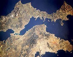
The South Euboean Gulf (Greek: Νότιος Ευβοϊκός Κόλπος, Notios Evvoïkos Kolpos) is a gulf in Central Greece, between the island of Euboea and the Greek mainland (Boeotia and Attica). With a total length of approximately 50 km and a width of 10 to 20 km, it stretches nearly diagonally from northwest to southeast, from the Euripus Strait, which connects it to the North Euboean Gulf, to the Petalies Gulf near Agia Marina in the south.

Contents

Map of Notios Evoikos Kolpos

Islands

  • Petalioi (largest islands:Megalonisos, Chersonisi), Kavaliani, Stouronisi
  • Bays by the gulf

  • Agion Apolstolon Bay, south
  • Oropos Bay, southwest
  • Aliveri Bay, north
  • Boufalo Bay, northeast
  • Almyropotamos Bay, northeast
  • Places by the gulf

  • Sessi Beach, south
  • Varnavas Beach, south
  • Kalamos Beach, southwest
  • Nea Palatia, southwest
  • Skala Oropou, southwest
  • Chalkoutsi, southwest
  • Pigadaki, southwest
  • Dilessi, west
  • Paralia Achlidas, west
  • Faros, west
  • Chalkida, northwest
  • Eretria, northwest
  • Amarynthos, north
  • Aliveri, north
  • Panagia, northeast
  • References

    South Euboean Gulf Wikipedia


    Similar Topics