Neha Patil (Editor)

South Dakota Highway 47

Updated on
Edit
Like
Comment
Share on FacebookTweet on TwitterShare on LinkedInShare on Reddit
Existed:
  
1927 – present

Length
  
387.6 km

South end:
  
N-137

Constructed
  
1927

South Dakota Highway 47

North end:
  
37th Avenue Southeast at the North Dakota border

Major cities
  
High, Gregory, Bowdle, Reliance, Eureka, Burke, Fort Thompson, Seneca

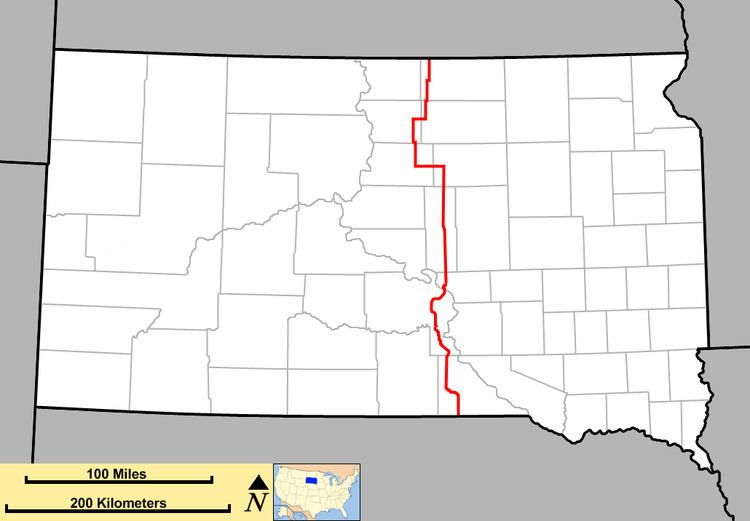
South Dakota Highway 47 (SD 47) is a state route that runs north to south across the central portion of South Dakota. It begins at an unnumbered highway at the North Dakota border north of Eureka, and ends at the Nebraska border, where it becomes Nebraska Highway 137. It is just under 241 miles (388 km) in length.

Contents

Map of SD-47, South Dakota, USA

History

When initially established in the mid-1920s, South Dakota 47 extended from U.S. Highway 16 at Pukwana to U.S. Highway 18 at Wheeler, along what is currently portions of South Dakota Highway 50 and Charles Mix County Highway 49. Several alignment changes have occurred since then:

  • Around 1932: The south end of SD 47 was truncated at Platte.
  • Around 1936: The north end of SD 47 was extended west to Chamberlain, then north to the intersection of U.S. Highway 14 at Highmore.
  • Around 1939: The segment between Pukwana and Platte was redesignated as part of South Dakota Highway 43. SD 47 was rerouted west from Chamberlain to Oacoma, then extended southward to U. S. 18 at Gregory.
  • Circa 1950: South end extended to the Nebraska border, via a shared alignment with U. S. 18 to Burke.
  • 1955: In Oacoma, SD 47 was rerouted west to near Reliance, before heading south to meet with the old alignment near the White River. On the north end, SD 47 was extended north to Eureka via Lebanon and Bowdle.
  • 1965: North end was extended to the North Dakota border.
  • 1976: The segment between Ft. Thompson and Reliance, which had previously passed through Chamberlain and Oacoma, was rerouted onto the more direct road formerly known as South Dakota Highway 47W, which had been constructed around 1965. The previous segment between Ft. Thompson and Chamberlain was designated as an extension of South Dakota Highway 50.
  • South Dakota Highway 47W was a state route located in central South Dakota. SD 47W designated around 1965, on a newly constructed road linking Fort Thompson and Reliance. This designation was used only for 10 years; it was made part of South Dakota Highway 47 when a portion of that route was realigned.

    References

    South Dakota Highway 47 Wikipedia