
Existed: 1976 – present Length 75.7 km | Constructed 1976 | |
 | ||
Counties | ||
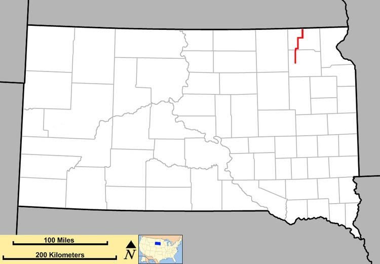
South Dakota Highway 27 (SD 27) is a state route located in northeast South Dakota. It begins at a junction with U.S. Route 12 (US 12) southeast of Andover, and terminates at the North Dakota state line, continuing north as North Dakota Highway 32 (ND 32). The highway is just over 47 miles (76 km) in length.
Contents
Map of SD-27, South Dakota, USA
Route description
SD 27 begins at an intersection with US 12 near Andover, and heads north through open plains. It passes west of Pierpont Lake and the town of Pierpont before leaving Day County and entering Marshall County. Just north of the county line, the highway enters Langford and turns due east for a few miles before curving back to the north toward Britton. Once it reaches Britton, SD 27 crosses the Dakota, Missouri Valley and Western Railroad, then meets SD 10. The two highways run east, cross the railroad again and then leave the city. About six miles (9.7 km) east of Britton, SD 27 and SD 10 split, the former runs north and the latter continues east. SD 27 runs north for approximately ten miles (16 km) before crossing into North Dakota and becoming ND 32.
History
This is the second usage of the SD 27 identifier. In 1926, the first SD 27 was designated in the southeast part of the state. It ran from Olivet south to near Tabor. This road became part of SD 35 in 1936, and is now the southern segment of SD 25. The current alignment was designated in 1926. It used to be the northern end of SD 25, which was rerouted farther east.