
South end: US 12 near Gretna Counties: Edmunds | Length 29.01 km | |
 | ||
County | ||
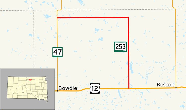
South Dakota Highway 253 (SD 253) is an 18.024-mile-long (29.007 km) state highway in the U.S. state of South Dakota. It runs in Edmunds County from U.S. Route 12 (US 12) west of Roscoe to SD 47 north of Bowdle. The route is maintained by the South Dakota Department of Transportation (SDDOT) and is not a part of the National Highway System.
Contents
Map of SD-253, South Dakota, USA
Route description
SD 253 begins at an intersection with US 12 near Gretna and heads north through flat farmland. It passes a railroad almost immediately and continues north. The route passes by a couple of lakes and turns west. Directly after turning east, SD 253 enters the city of Hosmer. After running through the city, the highway passes by a cemetery and treks west. The route reaches its northern terminus approximately eight miles (13 km) west of Hosmer at an intersection with SD 47.
SD 253 is maintained by SDDOT. In 2012, the traffic on the road was measured in average annual daily traffic. The highway had an average of 214 vehicles on the north–south segment and an average of 195 vehicles on the east–west segment. The designation is not a part of the National Highway System, a system of highways important to the nation's defense, economy, and mobility.
Major intersections
The entire route is in Edmunds County.