
Number of households 614 | Area 109 ha | |
 | ||
Restaurants Chez Jose', Block & Board, Chez Jose | ||
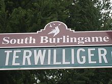
South Burlingame is a neighborhood in the Southwest section of Portland, Oregon. It is bordered by Multnomah to the west, Hillsdale and South Portland to the north, River View Cemetery (Portland, Oregon) to the east, and Markham, Marshall Park, and Collins View to the south.
Contents
Map of South Burlingame, Portland, OR 97219, USA
Interstate 5 cuts through the northern part of the neighborhood, separating the Fulton Park area from the rest of South Burlingame.
History
South Burlingame was formed on June 7, 1910 when B.M. Lombard, in partnership with Fulton Park Land Company, recorded a replat to a 272-acre (1.10 km2) section of land that was, at the time, a part of the Fulton Park District.
The original Fulton Park District was 411 acres (1.66 km2), and was formed on July 20, 1888 when Philip A. Marquam sold the land to the South West Portland Company for $150,000. It included the present day South Burlingame neighborhood as well as an eight block corridor of land that follows Terwilliger Boulevard north from Interstate 5 to Capital Highway.
Prior to 1888 the original land was part of the Thomas F. Stephens donation land claim and was purchased from him in two separate transaction in 1858 and 1868.