
Number of households 3,397 | Area 5.206 km² | |
 | ||
Restaurants Oak and Olive Restaurant, Salvador Molly's, Baker & Spice, Casa Colima Mexican, La Costita Barbur | ||
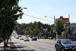
Bus pushes into bike lane hillsdale portland oregon usa
The Hillsdale district is a neighborhood in the southwest section of Portland, Oregon, United States. It is centered on the Hillsdale retail and business area, a series of strip malls on SW Capitol Highway between SW Sunset Boulevard and SW Bertha Boulevard. It is home to the Hillsdale Farmer's Market, which takes place on Sundays during the Summer and every other Sunday during the Winter.
Contents
- Bus pushes into bike lane hillsdale portland oregon usa
- Map of Hillsdale Portland OR USA
- Near right hook by oregon efu 269 capitol highway hillsdale portland oregon usa
- Education
- References
Map of Hillsdale, Portland, OR, USA
Hillsdale borders Southwest Hills, Healy Heights, and Homestead on the north, South Portland on the east, South Burlingame and Multnomah on the south, and Hayhurst and Bridlemile on the west.
Oregon Route 10 connects Hillsdale to Downtown Portland to the north and Raleigh Hills and Beaverton to the west.
Near right hook by oregon efu 269 capitol highway hillsdale portland oregon usa
Education
References
Hillsdale, Portland, Oregon Wikipedia(Text) CC BY-SA