
 | ||
Central massachusetts railroad somerville ma somerville community path
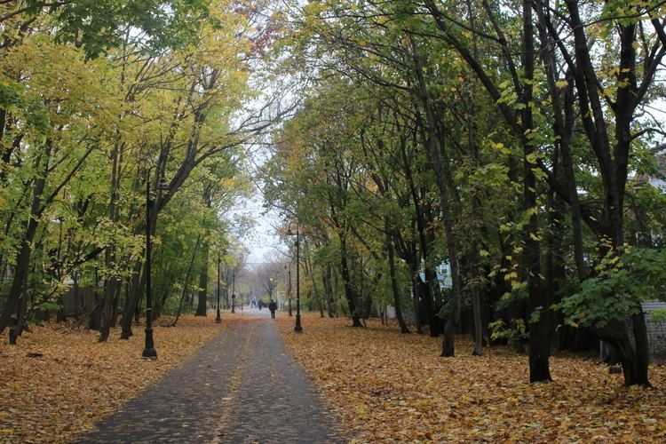
The Somerville Community Path is a paved mixed-use path in Somerville, Massachusetts, running 0.8 mile (1.3 km) from the Alewife Linear Park border to Lowell Street via Davis Square.
Contents
- Central massachusetts railroad somerville ma somerville community path
- Map of Somerville Community Path Massachusetts USA
- History
- Proposed extension
- Revised plan
- References
Map of Somerville Community Path, Massachusetts, USA
The Somerville Community Path is a continuation of the Cambridge Linear Park, which runs from the Cambridge-Somerville border west to Alewife Station, the Fitchburg Cutoff Path, and the Minuteman Bikeway. Proceeding eastbound, the bicycle and pedestrian paths diverge slightly just before Seven Hills Park, to pass through Davis Square. Pedestrians have grade-level crosswalks, and bicyclists are routed via nearby streets or may walk their bikes. They join again at Grove Street and continue to Lowell Street (though there is an MBTA busway linking Grove Street to College Avenue).
The original path connected Alewife Linear Park to Davis Square, and was completed in 1985. A stretch of 0.6 mile (1.0 km) heading east from Davis Square to Cedar Street was constructed in 1992, and in 2013, construction began on a further extension to Lowell Street, which officially opened in August 2015.
History
The Boston and Lowell Railroad was chartered in 1830 and started service in 1835. The main line is now the MBTA Lowell Line. From near Alewife on the Cambridge-Arlington border, to Lowell Street in Somerville, the Cambridge Linear Park and Somerville Community Path follow a railroad right-of-way that was laid out in 1870, and later known as the "Fitchburg Freight Cutoff", "Somerville Freight Cut-off", "Somerville Freight Spur", or Davis Square Freight Cut-Off. (In the 1980s and 1990s, after the Red Line extension, there remained an active freight spur from the Lowell Line to the "MaxPak" site, where the last industrial user went out of business in 2002.) The Boston and Lowell built the connection from its main line (at Somerville Junction, near modern-day Lowell Street), to the Lexington and Arlington Railroad (now mostly converted to the Minuteman Bikeway), which the Boston and Lowell had just acquired. Passenger service ran via this connection from 1870 until 1927. An extension connected to the Fitchburg Railroad main line, now the MBTA Fitchburg Line, between what are now Alewife Station and Brighton Street, Belmont.
After various corporate acquisitions and the decline of railroad service in the United States, the public Massachusetts Bay Transportation Authority acquired the rights of way in 1973. The existing paths from Alewife to Davis Square were created in 1985 by the MBTA, Cambridge, and Somerville, in conjunction with the extension of the MBTA Red Line from Harvard to Alewife. The Davis-to-Alewife segment of the Red Line was built using a cut-and-cover method. The surface landscaping for the path was added after subway tunnel construction was complete. Between Davis and Porter, the subway diverges from the surface street pattern, using a deep bore tunnel.
Construction began on a quarter-mile (0.4 km) extension from Cedar Street to Lowell Street in 2013, with a targeted opening date in late 2014. The extension was quietly opened in mid-2015, with an official dedication ceremony on August 19.
Proposed extension
In April 2014, state officials announced that a 1.9 mile (3.0 km) community path extension would be built alongside the MBTA Green Line Extension, that would have created a continuous route from Bedford to Boston’s Charles River Bike Path.
As originally approved, the first phase of the $39 million project would connect a relocated Lechmere Station to the new Washington Street station, east of Union Square. The remaining stretch will connect Washington Street to the new Lowell Street Station near Magoun Square. The Massachusetts Department of Transportation produced a 3-D virtual tour of the proposed extension. Construction to extend the path from where it currently ends at Cedar Street to Lowell Street is already underway. The additional extension east of Lowell Street is due to be completed in 2020.
Revised plan
The Green Line Extension project was found to be far over budget in 2015 and, on May 9, 2016, a revised plan for the Green Line Extension was proposed that would not incorporate a community path in the viaduct that will be built on the southern portion of the project, so as to save money. As a result, the community path will now terminate at Washington Street, Somerville instead of Water Street in Cambridge. The new path design shifts from the west side of the track to the east side and then back again between Central Street and School Street and has fewer entrances from cross streets. South of Washington Street, bike commuters would have to use city streets, including the McGrath Highway, to reach the Charles River Bike Path network and downtown Boston.