
Founded 1809 Website somersetcounty-me.org Population 51,706 (2013) Unemployment rate 7.8% (Apr 2015) | Area 10,603 km² | |
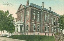 | ||
Points of interest Mount Bigelow, Skowhegan Indian, Eaton Mountain, L C Bates Museum, History House Destinations | ||
Somerset county maine
Somerset County is a county located in the state of Maine, in the United States. As of the 2010 census, the population was 52,228. Its county seat is Skowhegan.
Contents
- Somerset county maine
- Map of Somerset County ME USA
- History
- Government and politics
- Geography
- Mountains
- Bodies of water
- Adjacent counties and municipalities
- 2000 census
- 2010 census
- School administrative districts
- Secondary schools
- Higher education
- Miscellaneous
- Census designated places
- Plantations
- Unorganized territories
- Villages
- References
Map of Somerset County, ME, USA
History
Somerset County was established on March 1, 1809 from portions of Kennebec County and was named after Somerset County in England.
Government and politics
Somerset County is part of Maine's 2nd congressional district.
In 1992 Somerset County was one of three counties in the state (the others being Knox and Piscataquis) where Ross Perot received over 38% of the vote and won. In 2008 Barack Obama received 51.9% of the vote.
Geography
According to the U.S. Census Bureau, the county has a total area of 4,094 square miles (10,600 km2), of which 3,924 square miles (10,160 km2) is land and 169 square miles (440 km2) (4.1%) is water. It is the third-largest county in Maine by area.
Mountains
Bodies of water
Adjacent counties and municipalities
Somerset County is one of few counties in the United States to border ten counties and county equivalents.
2000 census
As of the census of 2000, there were 50,888 people, 20,496 households, and 14,121 families residing in the county. The population density was 13 people per square mile (5/km²). There were 28,222 housing units at an average density of 7 per square mile (3/km²). The racial makeup of the county was 98.00% White, 0.24% Black or African American, 0.41% Native American, 0.34% Asian, 0.02% Pacific Islander, 0.11% from other races, and 0.89% from two or more races. 0.46% of the population were Hispanic or Latino of any race. 20.9% were of English, 17.7% French, 15.1% United States or American, 11.5% Irish and 8.8% French Canadian ancestry according to Census 2000. 96.2% spoke English and 2.9% French as their first language.
There were 20,496 households out of which 31.60% had children under the age of 18 living with them, 54.20% were married couples living together, 10.10% had a female householder with no husband present, and 31.10% were non-families. 24.60% of all households were made up of individuals and 10.20% had someone living alone who was 65 years of age or older. The average household size was 2.44 and the average family size was 2.87.
In the county, the population was spread out with 24.70% under the age of 18, 7.00% from 18 to 24, 28.70% from 25 to 44, 25.30% from 45 to 64, and 14.30% who were 65 years of age or older. The median age was 39 years. For every 100 females there were 96.00 males. For every 100 females age 18 and over, there were 93.30 males.
The median income for a household in the county was $30,731, and the median income for a family was $36,464. Males had a median income of $29,032 versus $20,745 for females. The per capita income for the county was $15,474. About 11.10% of families and 14.90% of the population were below the poverty line, including 19.40% of those under age 18 and 12.50% of those age 65 or over.
2010 census
As of the 2010 United States Census, there were 52,228 people, 21,927 households, and 14,353 families residing in the county. The population density was 13.3 inhabitants per square mile (5.1/km2). There were 30,569 housing units at an average density of 7.8 per square mile (3.0/km2). The racial makeup of the county was 97.1% white, 0.6% Asian, 0.5% American Indian, 0.4% black or African American, 0.1% from other races, and 1.3% from two or more races. Those of Hispanic or Latino origin made up 0.8% of the population. In terms of ancestry, 25.1% were French, 24.2% were English, 15.8% were Irish, 8.0% were German, 7.9% were American, and 6.1% were French Canadian.
Of the 21,927 households, 28.2% had children under the age of 18 living with them, 49.7% were married couples living together, 10.3% had a female householder with no husband present, 34.5% were non-families, and 26.9% of all households were made up of individuals. The average household size was 2.35 and the average family size was 2.80. The median age was 43.6 years.
The median income for a household in the county was $36,647 and the median income for a family was $47,177. Males had a median income of $41,235 versus $30,029 for females. The per capita income for the county was $20,709. About 14.0% of families and 18.4% of the population were below the poverty line, including 25.0% of those under age 18 and 12.7% of those age 65 or over.
School administrative districts
The following school districts are located at least partly in Somerset County: