
Opening date 1989 Surface area 212.3 km² | Length 760 m (2,493 ft) Height 39 m | |
 | ||
Similar Srisailam dam, Pulichinthala Project, Pothireddypadu Reservoir, Mylavaram Dam, Tatipudi Reservoir | ||
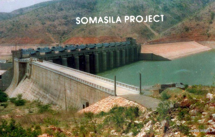
Somasila dam
The Somasila Dam is a dam constructed across the Penna River near Somasila, Nellore district, Andhra Pradesh, India. The reservoir impounded by the dam has a surface area of 212.28 km2 (52,456 acres) with live storage capacity of 1.994 km3 (1,616,562 acre·ft) or 75 tmcft.
Contents
- Somasila dam
- Map of Somasila Dam Chapurallapalle Andhra Pradesh
- Somasila dam reaches dead storage level tv5 ground report nellore tv5 news
- References
Map of Somasila Dam, Chapurallapalle, Andhra Pradesh
The reservoir can get water by gravity from the Srisailam reservoir located in Krishna basin. It is the biggest storage reservoir in Penna River basin and can store all the inflows from its catchment area in a normal year. This reservoir can also feed by gravity nearby 72 tmcft gross storage capacity Kandaleru reservoir. Under Indian Rivers Inter-link projects, it is planned to connect the reservoir with the Nagarjunasagar reservoir to augment its water inflows.somasila project under canal systems developed.
One of the main canals is the Kavali Canal. ayacut of this canal is wet ayacut was 25,000 acres and id ayacut was 50,000. Also developed the canal right and left sides un authorised ayacut was nearly 25,000 acres developed. Kavali canal is feeding to the 52 tanks under system of tanks. It will be covered dagadarthi mandal, sangham mandal, jaladanki mandal and kavali mandal. The total length of the canal is 67.619 km. Kavali Canal is the main source of drinking to Kavali municipality of nearly 1.2 lakh population.