Capital Sololá ISO 3166 code GT-SO Municipalities 19 | Department Sololá Time zone -6 Area 1,061 km² | |
 | ||
Points of interest Lake Atitlán, Volcán San Pedro, Museo Lacustre Atitlán, Volcán Atitlán, Cerro Tzankujil (Nature R Destinations | ||
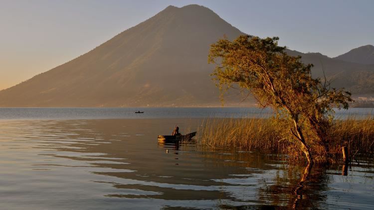
Sololá is a department in the west of Guatemala. The capital is the city of Sololá. Lake Atitlan is a key feature surrounded by a number of the municipalities.
Contents
Map of Solol%C3%A1, Guatemala
Municipalities
- Concepción
- Nahualá
- Panajachel
- San Andrés Semetabaj
- San Antonio Palopó
- San José Chacayá
- San Juan La Laguna
- San Lucas Tolimán
- San Marcos La Laguna
- San Pablo La Laguna
- San Pedro La Laguna
- Santa Catarina Ixtahuacan
- Santa Catarina Palopó
- Santa Clara La Laguna
- Santa Cruz La Laguna
- Santa Lucía Utatlán
- Santa María Visitación
- Santiago Atitlán
- Sololá
Population
As of 2011, the department had a population of 430,573, and the area was populated almost entirely by different Mayan ethnic groups, of which the two largest groups were Kaqchikel people and K'iche'. Kaqchikel people Accounted for 50.1% of the department's population, and K'iche' accounted for 35.3% of the department's population. Indigenous people account for 96.5% of the department's population.
Economy
Fertile soil makes Sololá a producer of maize, wheat, barley, vegetables, and fruit. Fruits include apples, cherries, cherimoya, peaches, and pears. Livestock is also common, and as 1850, the region had a large wool industry.
Ecology
The area is very mountainous and also sits on the sea. In 1850, the British described it as having a "healthy" climate "rather inclining to cold, or...temperate." Temperatures warm further south. Lago de Atitlán is located in Sololá.
Sports
Saprissa de Guatemala is Solola's main football team and the most famous club in the department.
