
Time zone Mountain (UTC-7) Population 5,576 (2013) Area code 928 | Founded 1878 Elevation 1,732 m Local time Friday 7:27 PM | |
 | ||
Weather 13°C, Wind NW at 5 km/h, 20% Humidity Area 80.03 km² (79.77 km² Land / 26 ha Water) Founders Erastus Snow, William J. Flake | ||
Snowflake is a town in Navajo County, Arizona, United States. It was founded in 1878 by Erastus Snow and William Jordan Flake, Mormon pioneers and colonizers. It has frequently been noted on lists of unusual place names. According to 2012 Census Bureau estimates, the population of the town is 5,564.
Contents
- Map of Snowflake AZ 85937 USA
- Geography
- Demographics
- Seasonal events
- Education
- Climate
- In popular culture
- Notable people
- References
Map of Snowflake, AZ 85937, USA
Snowflake is 25 miles south of Interstate 40 (formerly U.S. Route 66) via Highway 77. The Apache Railway provides freight service, from 1961 to 2012 serving the Snowflake Mill.
Geography
Snowflake is located at 34°30′40″N 110°4′59″W (34.511187, -110.082974).
According to the United States Census Bureau, the town has a total area of 30.9 square miles (80 km2), of which, 30.8 square miles (80 km2) of it is land and 0.1 square miles (0.26 km2) of it (0.16%) is water.
Demographics
As of the census of 2000, there were 4,460 people, 1,312 households, and 1,070 families residing in the town. The population density was 144.8 people per square mile (55.9/km²). There were 1,536 housing units at an average density of 49.9 per square mile (19.2/km²). The racial makeup of the town was 87.24% White, 0.27% Black or African American, 6.93% Native American, 0.49% Asian, 0.07% Pacific Islander, 3.00% from other races, and 2.00% from two or more races. 8.05% of the population were Hispanic or Latino of any race.
There were 1,312 households out of which 46.5% had children under the age of 18 living with them, 69.5% were married couples living together, 9.1% had a female householder with no husband present, and 18.4% were non-families. 15.8% of all households were made up of individuals and 6.7% had someone living alone who was 65 years of age or older. The average household size was 3.37 and the average family size was 3.81.
In the town, the population was spread out with 37.9% under the age of 18, 9.8% from 18 to 24, 21.8% from 25 to 44, 19.8% from 45 to 64, and 10.7% who were 65 years of age or older. The median age was 28 years. For every 100 females there were 99.7 males. For every 100 females age 18 and over, there were 95.3 males.
The median income for a household in the town was $37,439, and the median income for a family was $42,500. Males had a median income of $30,517 versus $21,164 for females. The per capita income for the town was $13,391. About 10.4% of families and 15.0% of the population were below the poverty line, including 18.7% of those under age 18 and 14.1% of those age 65 or over.
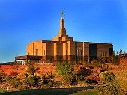
Recently, the town and surrounding area have experienced steady growth, primarily to the east, west and south. An additional 9-holes were added to the 18-hole golf course where the Snowflake Arizona Temple was built by The Church of Jesus Christ of Latter-day Saints in 2002. To the east of town, a substantial community of individuals suffering from multiple chemical sensitivity syndrome (MCS) has grown since the 1980s. As of July 2016 there were approximately 20 households comprising this community of individuals.
Seasonal events
Education
Snowflake is a part of the Snowflake Unified School District, consisting of Highland Primary School, Snowflake Intermediate School, Snowflake Junior High and Snowflake High School. Taylor Elementary School in the neighboring town of Taylor, Arizona is also part of the Snowflake Unified school District.
Northland Pioneer College's Silver Creek campus extension is located in Snowflake.
Climate
Snowflake experiences a four-season climate with a warm (sometimes hot) summer, mild autumn, mild to cold winter and cool, windy spring. Typical high temperatures hover around 90 °F (32 °C) during July and August and 30 to 55 °F (13 °C) in December/January.