
- right North Fork Smith River Basin area 1,862 km² Mouth elevation 0 | Length 40 km Basin area 1,860 km² Country United States of America | |
 | ||
- left Middle Fork Smith River, South Fork Smith River - average 3,748 cu ft/s (106 m/s) - max 228,000 cu ft/s (6,456 m/s) Sources North Fork Smith River, Middle Fork Smith River | ||
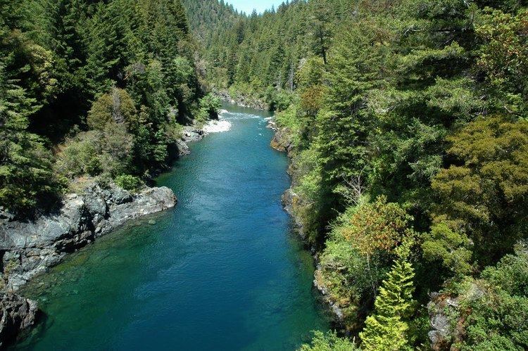
The Smith River (Tolowa: xaa-wvn’-taa-ghii~-li~’, nii~-li~’) is a river on the Pacific coast of extreme northwestern California, in the United States. It is about 25.1 miles (40.4 km) long, all in Del Norte County, and it flows through the Rogue River-Siskiyou National Forest, Six Rivers National Forest, and Jedediah Smith Redwoods State Park.
Contents
Map of Smith River, California, USA
CourseEdit
The Smith River is formed by the confluence of its middle and north forks in Del Norte County, in the extreme northwest corner of California, near the community of Gasquet. The Middle Fork, 27.8 miles (44.7 km) long, rises in Del Norte County, approximately 60 miles (100 km) northeast of Crescent City, and flows west. The North Fork Smith River, 28.1 miles (45.2 km) long, rises in Oregon on the northeast slope of Chetco Peak. The South Fork Smith River enters the Smith River near the community of Hiouchi. The 43.3-mile-long (69.7 km) fork rises on the eastern edge of the Smith River National Recreation Area, approximately 30 miles (48 km) east-northeast of Crescent City, flowing southwest and then northwest.
From the confluence with the South Fork, the Smith River flows generally northwest, entering the Pacific Ocean near the community of Smith River, approximately 10 miles (16 km) north of Crescent City. Smith River estuary is recognized for protection by the California Bays and Estuaries Policy.
WatershedEdit
The river's watershed catchment area is 719 square miles (1,860 km2). It drains a rugged area of the western Klamath Mountains and Northern Outer California Coast Ranges, west of the Siskiyou Mountains, just south of the Oregon border, and north of the watershed of the Klamath River.
By average discharge, the Smith is the largest river system in California that flows freely along its entire course. The highly variable annual flow is approximately 3,746 cu ft/s (106.1 m3/s), with an average monthly high of 8,432 cu ft/s (238.8 m3/s) in January, and an average low of 336 cu ft/s (9.5 m3/s) in September. The all-time highest flow was 228,000 cubic feet per second (6,500 m3/s) on December 22, 1964 during the Christmas flood of 1964.
The river was named for the explorer Jedediah Smith.
ConservationEdit
The free-flowing nature of the river—without a single dam along its entire length—makes it especially prized among conservationists and is considered one of the crown jewels of the National Wild and Scenic River program.