
Demonym(s) Slochtenaar Postcode 9615–9629, 9939 Area 158.8 km² | Elevation −1 m (−3 ft) Time zone CET (UTC+1) Website www.slochteren.nl Local time Friday 8:07 AM Area code 0598 | |
 | ||
Weather 4°C, Wind NE at 13 km/h, 82% Humidity Points of interest Fraeylemaborg, Geologisch&Archeologisch Streekmuseum, Politiepettenmuseum | ||
Slochteren ( [ˈslɔxtərən]) is a village and municipality with a population of 15,546 in the province of Groningen in the northeast of the Netherlands.
Contents
Map of Slochteren, Netherlands
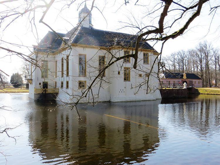
The municipality can be characterized as a chain of small villages dividing a mostly agricultural landscape. Having an agricultural background for at least a thousand years, the community houses for the most part commuters to nearby towns like Hoogezand, Groningen and Delfzijl. The mansion Fraeylemaborg (a small 'castle', the oldest parts of which are dated in the Middle Ages) is located in Slochteren.
Geography
The population centres in the municipality are:
Topographic map of the municipality of Slochteren, June 2015
Natural gas field
Slochteren is in the center of the giant Groningen gas field, discovered in 1959, ensuring the position of the Netherlands as a major energy exporting country. The estimated gas reserves in 2009 was 2,700 km3 (650 cu mi).