
Country Netherlands Offshore/onshore onshore Start of production 1963 | Discovery 1959 Start of development 1959 | |
 | ||
Operator Nederlandse Aardolie Maatschappij BV Current production of gas 93×10^ m/d3.3×10^ cu ft/d Estimated gas in place 2.8×10^ m100×10^ cu ft | ||
Platts gas power watch dutch government s groningen gas field policy and its market impact
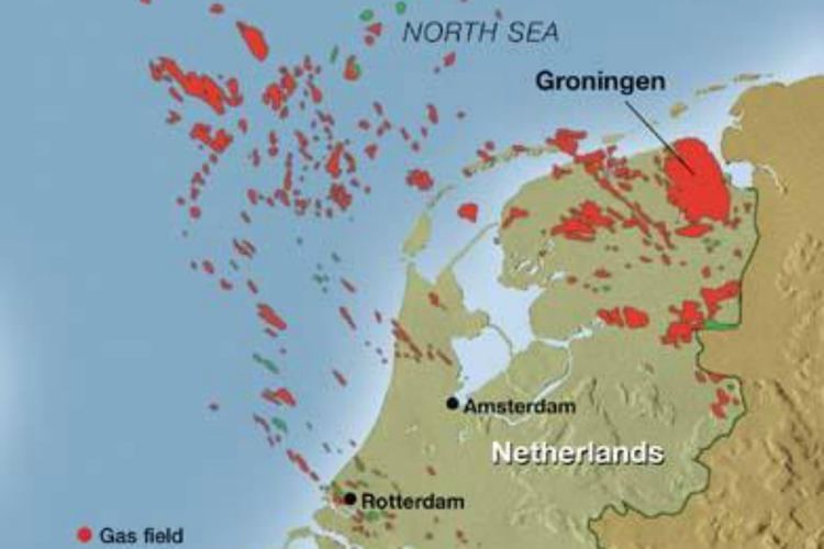
The Groningen gas field is a giant natural gas field located near Slochteren in Groningen province in the northeastern part of the Netherlands. Discovered in 1959, it is the largest natural gas field in Europe and the tenth-largest in the world.
Contents
- Platts gas power watch dutch government s groningen gas field policy and its market impact
- Simotics amb technology maximum availability in groningen gas field
- History
- Present
- Regional setting
- Reservoir
- Sources
- Trap
- Seal
- References
Simotics amb technology maximum availability in groningen gas field
History
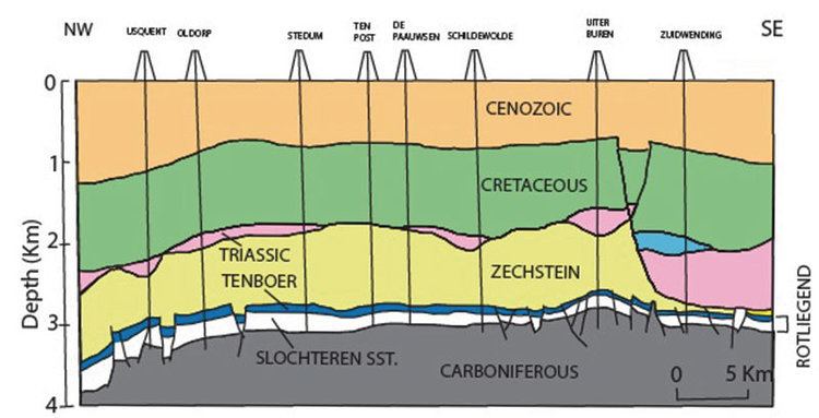
After two previous unsuccessful wells were commissioned to search for oil and gas, on 22 July 1959, the Slochteren 1 well, drilling to a depth of 3,000 metres (9,800 ft), discovered the huge 2.8 trillion cubic meters (100 trillion cubic feet) gas field in the porous Rotliegend sandstone formation, which is 130 metres (430 ft) to 140 metres (460 ft) thick and 45 kilometres (28 mi) long from north to south by 25 kilometres (16 mi) long from east to west. The field started production in 1963 and produced around 100 billion cubic meters (3.57 trillion cubic feet) per year in the first decade of production but gradually the annual production fell to around 35 billion cubic meters (1.25 trillion cubic feet) per year. As of 2009 the Groningen gas field has produced around 1,700 billion cubic meters (60.7 trillion cubic feet) which represents 60% of the total reserves of the field but the remaining 1,100 billion cubic meters (39.3 trillion cubic feet) are expected to last for another 50 years.

The Groningen gas field is operated by the Nederlandse Aardolie Maatschappij BV (NAM), a joint venture between Royal Dutch Shell and ExxonMobil with each company owning a 50% share. The field accounts for 50% of the natural gas production in the Netherlands, the other 50% being supplied by around 300 smaller gas fields, most of them located offshore in the North Sea.
Present
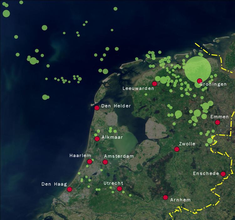
After demonstrations in Groningen because of the increase in induced earthquakes, the Dutch government decided on January 17, 2014 to cut output from the gas field and pay those affected by the earthquake a compensation worth 1.2 billion Euro, spread over a period of 5 years. The ministry said production would be cut in 2014 and 2015 to 42.5 bcm and in 2016 to 40 bcm.
The State Supervision of Mines has brought forward that the production level should be cut back to 30 bcm to avoid the more severe quakes. Although it is technically possible to reduce Groningen's output to this level and still meet domestic demand, the ministry keeps production high (currently 39.4 bcm per year). Groningen officials are not satisfied with the measures. As of January 2015, no houses have been reinforced, nothing has been done about many seriously damaged buildings, and the risk of severe quakes, possibly resulting in collapsed buildings, injuries and death, is still too high. In June 2016, the Netherlands' National Mines Inspectorate advised the Dutch Government to reduce production even further to 24 bcm per year. On September 23, 2016, Dutch Prime Minister Mark Rutte confirmed that gas extraction from the northern Groningen gas field will be held at 24 bcm per year for the coming five years.
Regional setting
The Groningen field lies within the Southern Permian Basin, which extends from the eastern coast of England to Poland. Within this area large volumes of gas have been discovered, mainly reservoired in the Rotliegend sandstone, with producing fields in England, the Netherlands, Germany, Denmark and Poland.
Reservoir
The main reservoir in the Groningen field is the Cisuralian (Lower Permian), Rotliegend Slochteren sandstone. The Rotliegend reservoir at Groningen is mainly an aeolian sand with local development of fluvial wadi sands.
Porosities lie generally in the range 15–20% with permeabilities in the range 0.1–3000 mD.
Sources
The main source rock for the gas at Groningen are coals and carbonaceous shales within the Westphalian coal measures sequence that lies unconformably beneath the Rotliegend. These sources are dominated by type III kerogen.
Trap
The Groningen structure is a NNW-SSE trending intrabasinal high formed by normal faulting during the Mesozoic, particularly during the Late Jurassic to early Cretaceous. It has an overall horst geometry, lying between the Ems Graben to the east and the Lauwerszee Trough to the west.
Seal
The Rotliegend is covered by the Late Permian Zechstein evaporite sequence, consisting of carbonate, anhydrite and halite, which provides an effective seal to the gas accumulations within the underlying sandstone.