
Topo map USGS Neels Gap Prominence 139 m | Elevation 1,322 m Parent range Blue Ridge Mountains | |
 | ||
Similar Coosa Bald, Blood Mountain, Wolfpen Ridge, Double Spring Knob, Dick's Knob | ||
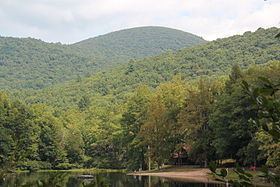
Slaughter Mountain, with an elevation of 4,338 ft (1,322 m), is the ninth-highest peak in the U.S. state of Georgia. It is located in Union County, Georgia and is the second-highest mountain in Union County. Its nearest neighbor is Blood Mountain, the highest peak in Union County and fifth-highest in Georgia.
Map of Slaughter Mountain, Georgia 30572, USA
References
Slaughter Mountain Wikipedia(Text) CC BY-SA