
Country United States County Hamilton FIPS code 39-72648 Elevation 256 m Population 1,717 (2010) | State Ohio Time zone Eastern (EST) (UTC-5) GNIS feature ID 1049180 Area 170 ha | |
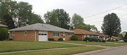 | ||
Skyline Acres is a census-designated place (CDP) in Colerain and Springfield townships, Hamilton County, Ohio, United States. The population was 1,717 at the 2010 census.
Geography
Skyline Acres is located at 39°13′45″N 84°34′5″W, 11 miles (18 km) north of downtown Cincinnati. It is bordered by Mount Healthy to the east, North College Hill to the southeast, White Oak to the southwest, Groesbeck to the west, and Northbrook to the north. Ohio State Route 126, the Ronald Reagan Cross County Highway, runs through the southern part of the CDP.
According to the United States Census Bureau, the CDP has a total area of 0.66 square miles (1.7 km2), all land.
References
Skyline Acres, Ohio Wikipedia(Text) CC BY-SA