
Postal code 32-043 Area 2.97 km² Local time Thursday 12:41 PM | Time zone CET (UTC+1) Car plates KRA Population 3,693 (2006) | |
 | ||
Weather 4°C, Wind E at 21 km/h, 95% Humidity | ||
Skała [ˈskawa] is a town in southern Poland, situated in the Lesser Poland Voivodeship (since 1999), previously in Kraków Voivodeship (1975-1998). On December 31, 2010, its population was 3,646.
Contents
Map of Ska%C5%82a, Poland
Skala is one of the oldest town of Lesser Poland. In the early 13th century, it was a defensive gord, known as Scala and Magna Schala. Its name (the Polish word skala means rock in English) probably comes from a rocky hill above the Pradnik river valley.
History
During the period known as Fragmentation of Poland (1148 - 1320), Skala was the object of frequent clashes between the Piast dynasty princes. In 1228, a battle took place here between the army of Silesian prince Henry I the Bearded and Mazovian duke Konrad I of Masovia. The Silesians won, forcing Mazovian units to retreat from Lesser Poland. Skala received Sroda Slaska rights on November 10, 1267, due to efforts of Salomea, the sister of duke Boleslaw V the Chaste. The town itself was located in the area of earlier village of Stankow (Stankoy), and became home to a monastery of the Order of Poor Ladies, who came here in the 1260s.
In the late Middle Ages Skala prospered, due to a convenient location on a merchant route from Kraków to Greater Poland. The town belonged to Krakow Voivodeship, and was a local center of trade, with several guilds and a brewery, whose beer was popular in Krakow. The town was famous for its shoemakers and butchers, who delivered their produce to the markets at Krakow. Skala burned in several fires (1611, 1737, 1763, 1810, 1914), and in 1580, its population was 218. In the year 1596, there were 92 houses at Skala, and a school. Like almost all towns in Lesser Poland, Skala was destroyed in the Swedish invasion of Poland (1655 - 1660).
In 1794, after the Battle of Raclawice, Tadeusz Kosciuszko designed Skala as a fortified camp, protecting northern approaches to the city of Krakow. On May 18, 1794, Prussian Army attacked and captured Skala. After the Partitions of Poland, the town briefly belonged to the Habsburg Empire, and in 1815 - 1915, it was part of Russian-controlled Congress Poland. As a result, the town was cut off from Krakow, which remained part of Austrian Galicia. Due to the proximity of the sealed border, the development of Skala was stopped for more than 100 years, as both Russian and Austrian governments did not promote mutual trade.
During the January Uprising, several skirmishes between Russian troops and Polish rebels took place in the area of Skala. In the nearby Ojcow a Polish camp was created, under Marian Langiewicz. On March 5, 1863, a battle took place at a Skala cemetery. As a result, in 1870 Russian authorities stripped Skala of its town charter. In the late 19th century the population of the village was 2,823, with 12% Jewish. In the first months of World War I, heavy fighting between Russians and Austrians took place here.
In the Second Polish Republic, Skala belonged to Kielce Voivodeship, with the population of 3593 (as for 1921). The village was captured and burned by the Wehrmacht on September 6, 1939 (see Invasion of Poland). During World War II, Skala was an important center of Polish resistance, in July 1944, the Home Army units fought the Germans in several skirmishes.
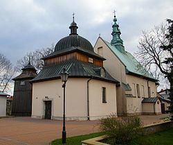
After the war, Skala remained a village until 1987. The town retains its medieval urban shape, with a large market square in the middle, and a stone monument of Saint Florian (ca. 1800). Skala is the seat of a gmina, and has a late Baroque church (18th century), with a wooden bell tower (1765).