
Nearest city Huntsville, AL Phone +1 205-489-5111 | Governing body U.S. Forest Service Established 1975 | |
 | ||
Area 24,922 acres (100.86 km) Management United States Forest Service Similar Bankhead National Forest, Sipsey River Trailhead, Black Warrior Work Cen, Thompson Creek - Sipsey Wi, Dismals Canyon | ||
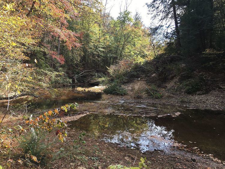
Sipsey wilderness backpacking trip 2016
The Sipsey Wilderness lies within Bankhead National Forest around the Sipsey Fork of the Black Warrior River in northwestern Alabama, United States. Designated in 1975 and expanded in 1988, the 24,922-acre (10,086 ha) Sipsey is the largest and most frequently visited Wilderness area in Alabama and contains dozens of waterfalls. It was also the first designated wilderness area east of the Mississippi River.
Contents
- Sipsey wilderness backpacking trip 2016
- Sipsey wilderness alabama january 14 15 2017
- History of creationEdit
- Official trailheadsEdit
- Official trailsEdit
- Places of interestEdit
- References
The wilderness consists of the low plateau of Brindlee Mountain which is dissected into a rough landscape by several creeks and rivers. Due to the layers of limestone and sandstone that make up the area, waterfalls are very common in the wilderness. This feature has earned the wilderness the nickname "Land of 1000 Waterfalls."
The wilderness is in the Appalachian mixed mesophytic forests ecoregion. Much of the wilderness was once logged, but new growth forests have now taken hold in the logged areas. Some old-growth forests can also be found in the wilderness. The most significant are about 260 acres (110 ha) along Bee Branch Gorge and Buck Rough Canyon, which include old Eastern Hemlock, American Beech, Sweet Birch, White Oak, and Tulip Poplar.
The Sipsey Wilderness Hiking Club promotes hiking in the Sipsey Wilderness.
Sipsey wilderness alabama january 14 15 2017
History of creationEdit
Faults in the 1964 Wilderness Act made it essentially impossible to designate a wilderness area anywhere east of the Mississippi River. Mary Ivy Burks of Birmingham worked to establish a Sipsey Wilderness Area in the Bankhead National Forest at a time when many believed that "The Wilderness Act" should apply only to the western part of the United States. She was in the forefront of what became known as the Eastern Wilderness Movement. Her work to secure the Sipsey Wilderness in the Bankhead National Forest was her crowning achievement. Alabama would be the agent of change, as a strange union of environmentalists, loggers, bird watchers, and others joined together to push to change the Act to allow for the designation of Sipsey as a wilderness area. Thanks to a bill introduced by Senator John Sparkman, the Eastern Wilderness Areas Act of 1975, the wilderness was finally designated with an original size of 12,000 acres (4,900 ha). The wilderness would be expanded in 1988. Thanks to the changes made to the Act, dozens of wilderness areas have been designated across the United States. The Sipsey Wilderness helped to show that a smaller plot of restored land in the eastern US could be a wilderness just as much as a larger tract of virgin land in the west.
Official trailheadsEdit
Directions to trailheads are available from the Sipsey Wilderness Hiking Club.
Official trailsEdit
Trail maps are available from the U.S. Forest Service, and from Briartech.
During the April 25–28, 2011 tornado outbreak there was extensive damage to much of the north Sipsey area. It was not considered feasible to fully repair the trail system at the time and efforts were focused on more popular routes. Several badly damaged trails were considered "abandoned" indefinitely, pending the resources to clear them. There is a notice to this effect placarded at the main Sipsey Trailhead, however this notice is not always present at outlying trailheads.
It appears that more recently (beginning in late 2013) some effort to clear and reroute the remainder of these trails has started taking place, although it is limited and trail reports continue to suggest difficulty hiking and following some less common trails. It is suggested that potential hikers find reliable recent information while planning a hike.