
Demonym(s) Simpelvelter Postcode 6350–6353, 6369 | Elevation 138 m (453 ft) Time zone CET (UTC+1) Area code 045 Local time Wednesday 7:22 AM | |
 | ||
Weather 1°C, Wind E at 14 km/h, 75% Humidity | ||
Simpelveld ( [ˈsɪmpəlˌvɛlt]; Limburgish: Zumpelveld) is a municipality and a town in the southeastern Netherlands. It is part of the municipal cooperative unit Parkstad Limburg.
Contents
Map of Simpelveld, Netherlands
Simpelveld is part of the Mergelland, named after the presence of chalk (mergel), hill country popular with tourists. The Mergellandroute passes through the town.
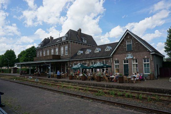
The population centre simpelveld has 28 national monuments, amongst which the Oude Molen and the Saint Remigius Church. Simpelveld has a heritage railway station and is the homebase of the South Limburg Railway Compagny. On one weekend in October there is a Day out with Thomas from the children's television series Thomas and Friends.
Population centres
Dutch topographic map of the municipality of Simpelveld, June 2015
Regional language
Simpelveld is part of The Netherlands and therefore the official language is Dutch. A lot of people also speak Simpelvelds, a regional language that depending of the definition belongs to Ripuarian or Limburgish. It is also referred to as Southeast Limburgish.