Harman Patil (Editor)

Sierra de Utiel

Updated on
Edit
Like
Comment
Share on FacebookTweet on TwitterShare on LinkedInShare on Reddit
Mountain type
  
Karstic (Jurassic)

Highest point
  
El Remedio

Elevation
  
1,306 m

Sierra de Utiel httpsuploadwikimediaorgwikipediacommonsthu

Listing
  
Mountains of the Valencian Community

Location
  
Plana d'Utiel and Serrans, Valencian Community

Parent range
  
Iberian System, Southeastern end

Mountains
  
Ropé, Juan Navarro, Cinco Pinos, El Remedio, La Atalaya, Cabeza del Fraile

Easiest routes
  
Sinarcas, Loriguilla, Domeño, Chera, Valencia, Benagéber, Calles

Similar
  
Pico Ropé, Sierra Martés, Pantano De Benagéber, Sistema Ibérico, Sierra de Enguera

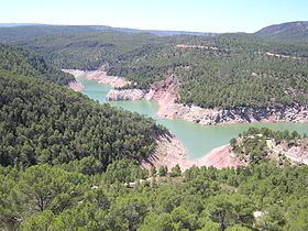
Sierra de Utiel (Valencian: Serra d'Utiel) is a 16.45 km (10 mi) long mountain range in the Alt Palància, Alt Millars and Plana Baixa comarcas, Valencian Community, Spain. Its highest point is the 1,306 m high El Remedio (Valencian: El Remei). There is often snow in the winter.

Contents

Xi marcha mountain bike sierra de utiel


Minor ranges

There are four ranges running parallel to each other:

  • Sierra del Negrete, also known as Sierra del Remedio (Valencian: Serra del Remei), the main range, with the 1,306 m high El Remedio (Valencian: El Remei), where there is a shrine and the Cerrochico (1,223 m).
  • The Sierra de Utiel proper with the 1,112 m high Cabeza del Fraile
  • The Sierra de Juan Navarro with the 1,177 m high Cinco Pinos, the Juan Navarro (1,167 m) and the Ropé (1,140 m), where both former ranges merge to meet the tectonic depression of Chera.
  • The Sierra de la Atalaya, whose highest summit is La Atalaya (1,157 m).
  • The Utiel Range has been declared a Site of Community Importance (SCI).

    References

    Sierra de Utiel Wikipedia