
Peak Cerro de Santa Cruz Elevation 1,423 m Parent range Sistema Ibérico | State/Province ES-AR First ascent Unknown Highest point Cerro de Santa Cruz Mountains Cerro de Santa Cruz | |
 | ||
Similar Sistema Ibérico, Serra de Vallivana, Sierra de Cucalón, Serra del Turmell, Montegordo | ||
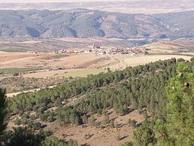
Sierra de Santa Cruz is a mountain range in the Campo de Daroca comarca, Aragon, Spain. It is located north of the Laguna de Gallocanta.
Contents
Map of Sierra de Santa Cruz, 50376, Zaragoza, Spain
Geography
The ridge is aligned in a NW-SE direction. Its highest point is Cerro de Santa Cruz (1,423 m). The Ermita de Santa Cruz shrine is located in the range.
This mountain chain rises west of Daroca and stretches through the municipal terms of Balconchán, Atea, Orcajo, Cubel, Valdehorna, Val de San Martín and Santed.
Ecology
The plant Centaurea pinnata is an endangered species present in this mountain range.
References
Sierra de Santa Cruz, Aragon Wikipedia(Text) CC BY-SA