
Elevation 2,167 m (7,110 ft) Range Penibaetic System | Parent range Cordillera Subbética Province Province of Jaén | |
 | ||
Location Granada province and Jaén provinceAndalusia Similar Pico Mágina, Sierras de Cazorla - Segura y, Baetic Depression, Despeñaperros, Sierra de Baza | ||
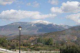
The Sierra Mágina is a massif mostly in the province of Jaén (southern Spain), part of the Cordillera Subbética. The highest peak is the Pico Mágina, with an elevation of 2,164 m.
Contents
Map of Sierra Magina, 23537, Ja%C3%A9n, Spain
Geography
The boundaries of the massif are grossly defined by the Guadalquivir valley from the north, the Guardiana Menor from east, and Guadahortuna from south and the Guadalbullón from south.
Protected area
Most of the chain is included in a natural park, the Parque Natural de Sierra Mágina.
The range can be reached from Albanchez de Mágina, Bedmar, Belmez de la Moraleda, Cambil, Huelma, Jimena, Jódar, Mancha Real, Pegalajar or Torres
References
Sierra Mágina Wikipedia(Text) CC BY-SA