
Elevation 1,214 m Province Province of Teruel Mountains Muela Carrascosa | Highest point Muela Carrascosa | |
 | ||
Parent range Iberian System, Eastern zone Easiest route | ||
Sierra Carrascosa is a mountain range in the Maestrazgo comarca of Aragon, Teruel Province, Spain. The highest point in the range is Muela Carrascosa (1,214 m). The Guadalope River flows along the NW side of the range.
Contents
Map of Sierra Carrascosa, 44559, Teruel, Spain
Geography
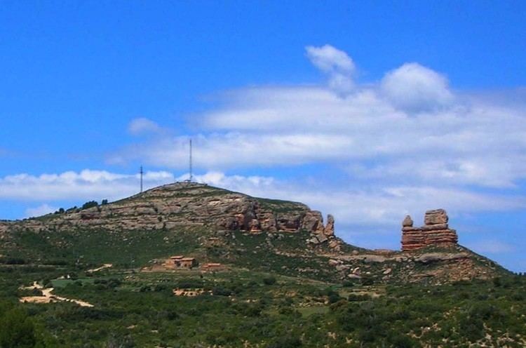
This 14 km long rocky range is located at the eastern end of the Iberian System and, like neighboring Sierra de Garrucha is characterized by very tight folds. Close to its northeastern end there is a very striking red rock formation known as El Guerrero Romano, "The Roman Soldier". It is a spectacular sight, very visible from A-226 road between Bordón and Castellote.
Villarluengo and Bordón are the most important towns in the vicinity of this range. The range is named after the Quercus coccifera spiny oak (Spanish: carrasca).
References
Sierra Carrascosa Wikipedia(Text) CC BY-SA