
Elevation 1,119 m Population 194 (2014) | Autonomous community Aragon Time zone CET (UTC+1) Area 157.9 km² Local time Monday 4:43 PM | |
 | ||
Weather 14°C, Wind NE at 13 km/h, 35% Humidity | ||
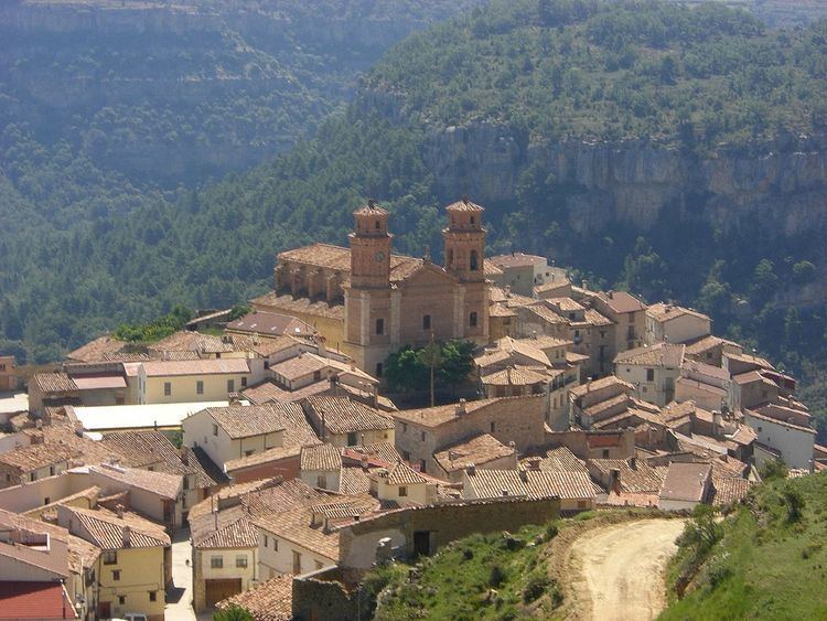
Villarluengo is a municipality at the heart of the mountainous Maestrazgo comarca, province of Teruel, Aragon, Spain. According to the 2010 census the municipality has a population of 188 inhabitants.
Map of 44559 Villarluengo, Teruel, Spain
Villarluengo is located on top of a spectacular rocky outcrop at the edge of a deep canyon, at the confluence of the Palomita and Cañada rivers. The town is surrounded by mountains, the Sierra de Garrocha, Sierra Carrascosa and Sierra de la Cañada mountain ranges, as well as the Muela Mujer and Muela Mochén mesa type mountains.
The municipal term includes the Las Fábricas abandoned mills and the small village of Montoro de Mezquita.
References
Villarluengo Wikipedia(Text) CC BY-SA