
 | ||
Shropshire way
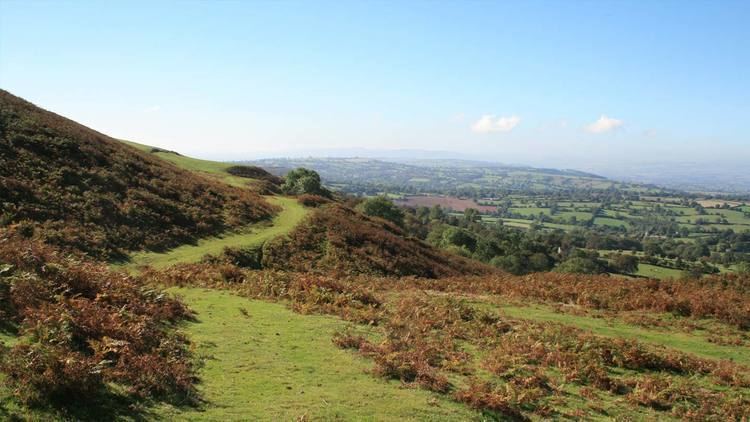
The Shropshire Way is a waymarked long distance footpath running through the English county of Shropshire. It runs 224 kilometres (139 mi) around the interior of the county in a large loop.
Contents
- Shropshire way
- Long mynd and shropshire way trail run
- The waymarked toute
- Additional loop
- South Shropshire
- Buzzard waymark
- Improvements
- References
Long mynd and shropshire way trail run
The waymarked toute
The route when marked on a map of the county loosely resembles a 'hangman's noose' with the rope dangling from the northern border of Shropshire at Grindley Brook. The route then runs south to Wem and then to Clive and Grinshill where the circular loop begins, taking you to Shrewsbury, then via Lyth Hill further south into the Shropshire Hills.
Additional loop
In the Shropshire Hills Area of Outstanding Natural Beauty an additional loop on the route runs to Stiperstones, Bishops Castle and Clun linking back to the main route via the Onny Valley at Little Stretton and the Long Mynd.
South Shropshire
The southern stretch of the loop runs through Craven Arms, Ludlow and via the two Clee Hills, Titterstone Clee Hill and Brown Clee Hill over high ground.
The path then traces Wenlock Edge to Much Wenlock, Ironbridge, Coalbrookdale over the Wrekin and Haughmond Hill back to Clive and Grinshill.
Buzzard waymark
The path is distinctly waymarked with a buzzard symbol in black and white usually easily seen from field edges and across most country.
Improvements
The southern section of the Shropshire Way has undergone a major refurbishment in 2007/2008. Extra sections have been added to make it circular in its own right and some original routes have been "tweaked" so they now go to more places of interest.