
Country United States County Monmouth Incorporated February 21, 1798 Population 1,098 (2000) | Formed October 31, 1693 Zip code 07724 Local time Sunday 5:30 AM | |
 | ||
Area rank 566th of 566 in state53rd of 53 in county Weather 5°C, Wind NW at 18 km/h, 70% Humidity | ||
Shrewsbury Township is a township in Monmouth County, New Jersey, United States. As of the 2010 United States Census, the township's population was 1,141, reflecting an increase of 43 (+3.9%) from the 1,098 counted in the 2000 Census, which was unchanged from the 1,098 counted in the 1990 Census.
Contents
- Map of Shrewsbury Township NJ 07724 USA
- History
- Creation of New Towns
- Geography
- Census 2010
- Census 2000
- Local government
- Federal state and county representation
- Politics
- Education
- Transportation
- Notable people
- References
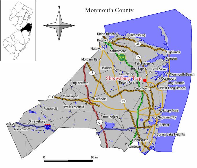
Map of Shrewsbury Township, NJ 07724, USA
History
Shrewsbury was part of the Navesink Patent or Monmouth Tract granted soon after the creation of East Jersey in 1665.
When it was formed in 1693, Shrewsbury Township covered an area of almost 1,000 square miles (2,600 km2), extending to the north to the Navesink River, south to include all of present-day Ocean County, east to the Atlantic Ocean and west to the present-day border of Monmouth County. It retained its size and scope until 1750, when Stafford Township was formed, taking away most of present-day Ocean County. The Parker Homestead, one of the oldest buildings in state, was built by early settlers to the region.
What is now Shrewsbury Township was originally formed on October 31, 1693, and was created as a township by the Township Act of 1798 of the New Jersey Legislature on February 21, 1798.
Creation of New Towns
Over the centuries, portions of the township have been taken to form Stafford Township (March 3, 1750), Dover Township (March 1, 1768, now Toms River Township), Howell Township (February 23, 1801), Ocean Township (February 24, 1849), Atlantic Township (February 18, 1847, now Colts Neck), Red Bank (March 17, 1870), Eatontown (April 4, 1873), Rumson (May 15, 1907), Fair Haven (March 28, 1912), Little Silver (March 19, 1923), Shrewsbury borough (March 22, 1926) and New Shrewsbury (April 15, 1950, now Tinton Falls). The township was named for Shrewsbury, England.
The remaining land was formerly owned by the Government and called Camp Vail, a housing complex for families of Fort Monmouth employees. After World War II the government planned to close the site but the established families, with no where else to go, purchased the land from the Army with the help of Ann Switek who arranged to maintain the Original Township Charter which had been abandoned. Ann Switek was then elected Town Clerk of Shrewsbury Township and maintained that post for close to 50 years. Camp Vail became Alfred Vail Mutual Association, one of New Jersey's first cooperative housing entities. Along with AVMA, Shrewsbury Township also contains Shrewsbury Arms apartments, a single convenience store/liquor store/deli called The Hideaway, and more recently, Shrewsbury Woods Townhouses.
Geography
According to the United States Census Bureau, Shrewsbury Township had a total area of 0.105 square miles (0.272 km2), all of which was land.
The borough borders the Monmouth County municipalities of Shrewsbury and Tinton Falls.
Census 2010
The 2010 United States Census counted 1,141 people, 583 households, and 265.8 families residing in the township. The population density was 10,877.7 per square mile (4,199.9/km2). The township contained 648 housing units at an average density of 6,177.7 per square mile (2,385.2/km2). The racial makeup of the township was 72.13% (823) White, 14.29% (163) Black or African American, 0.09% (1) Native American, 6.57% (75) Asian, 0.00% (0) Pacific Islander, 2.98% (34) from other races, and 3.94% (45) from two or more races. Hispanics or Latinos of any race were 14.11% (161) of the population.
Out of a total of 583 households, 22.1% had children under the age of 18 living with them, 25.4% were married couples living together, 15.6% had a female householder with no husband present, and 54.4% were non-families. 47.5% of all households were made up of individuals, and 22.5% had someone living alone who was 65 years of age or older. The average household size was 1.96 and the average family size was 2.79.
In the township, 18.8% of the population were under the age of 18, 6.5% from 18 to 24, 30.0% from 25 to 44, 26.8% from 45 to 64, and 18.0% who were 65 years of age or older. The median age was 41.9 years. For every 100 females the census counted 82.6 males, but for 100 females at least 18 years old, it was 76.2 males.
The Census Bureau's 2006-2010 American Community Survey showed that (in 2010 inflation-adjusted dollars) median household income was $51,548 (with a margin of error of +/- $8,211) and the median family income was $55,625 (+/- $11,553). Males had a median income of $44,844 (+/- $7,203) versus $36,136 (+/- $6,032) for females. The per capita income for the borough was $28,891 (+/- $3,658). About 3.1% of families and 7.8% of the population were below the poverty line, including 6.7% of those under age 18 and 11.0% of those age 65 or over.
Census 2000
As of the 2000 United States Census there were 1,098 people, 521 households, and 254 families residing in the township. The population density was 11,624.7 people per square mile (4,710.4/km²). There were 546 housing units at an average density of 5,780.6 per square mile (2,342.4/km²). The racial makeup of the township was 66.76% White, 16.67% African American, 10.02% Asian, 2.82% from other races, and 3.73% from two or more races. Hispanic or Latino of any race were 6.65% of the population.
There were 521 households out of which 24.6% had children under the age of 18 living with them, 28.6% were married couples living together, 16.3% had a female householder with no husband present, and 51.1% were non-families. 39.5% of all households were made up of individuals and 11.7% had someone living alone who was 65 years of age or older. The average household size was 2.10 and the average family size was 2.89.
In the township the population was spread out with 20.6% under the age of 18, 9.3% from 18 to 24, 37.8% from 25 to 44, 21.5% from 45 to 64, and 10.8% who were 65 years of age or older. The median age was 35 years. For every 100 females there were 93.3 males. For every 100 females age 18 and over, there were 90.0 males.
The median income for a household in the township was $36,875, and the median income for a family was $42,500. Males had a median income of $32,813 versus $30,598 for females. The per capita income for the township was $23,574. About 6.9% of families and 8.8% of the population were below the poverty line, including 12.7% of those under age 18 and 11.8% of those age 65 or over.
Local government
Shrewsbury Township is governed under the Township form of government. The governing body is a three-member Township Committee, whose members are elected directly by the voters in partisan elections to serve three-year terms of office on a staggered basis, with one seat coming up for election each year as part of the November general election in a three-year cycle. At an annual reorganization meeting, the Township Committee selects one of its members to serve as Mayor.
As of 2017, members of the Shrewsbury Township Committee are Mayor Edward P. Nolan (D, term on Township Committee ends December 31, 2018; term as mayor ends 2017); Deputy Mayor Glenwood J. Puhak (D, term on committee ends 2019; term as deputy mayor ends 2017) and Maryellen McNama-Bailly (R, term ends 2017).
With Maryellen McNama-Bailly taking office in January 2015, control of the council shifted to the Republican Party. Control of the Township Committee shifted to the Democratic Party on January 1, 2017.
Federal, state and county representation
Shrewsbury Township is located in the 4th Congressional District and is part of New Jersey's 11th state legislative district. Prior to the 2011 reapportionment following the 2010 Census, Shrewsbury Township had been in the 12th state legislative district. Prior to the 2010 Census, Shrewsbury Township had been part of the 12th Congressional District, a change made by the New Jersey Redistricting Commission that took effect in January 2013, based on the results of the November 2012 general elections.
New Jersey's Fourth Congressional District is represented by Christopher Smith (R). New Jersey is represented in the United States Senate by Cory Booker (D, Newark, term ends 2021) and Bob Menendez (D, Paramus, 2019).
For the 2016–2017 session (Senate, General Assembly), the 11th Legislative District of the New Jersey Legislature is represented in the State Senate by Jennifer Beck (R, Red Bank) and in the General Assembly by Joann Downey (D, Freehold Township) and Eric Houghtaling (D, Neptune Township). The Governor of New Jersey is Chris Christie (R, Mendham Township). The Lieutenant Governor of New Jersey is Kim Guadagno (R, Monmouth Beach).
Monmouth County is governed by a Board of Chosen Freeholders consisting of five members who are elected at-large to serve three year terms of office on a staggered basis, with either one or two seats up for election each year as part of the November general election. At an annual reorganization meeting held in the beginning of January, the board selects one of its members to serve as Director and another as Deputy Director. As of 2014, Monmouth County's Freeholders are Freeholder Director Lillian G. Burry (R, Colts Neck Township; term ends December 31, 2014), Freeholder Deputy Director Gary J. Rich, Sr. (R, Spring Lake; 2014), Thomas A. Arnone (R, Neptune City; 2016), John P. Curley (R, Middletown Township; 2015) and Serena DiMaso (R, Holmdel Township; 2016). Constitutional officers elected on a countywide basis are County Clerk M. Claire French (Wall Township), Sheriff Shaun Golden (Farmingdale) and Surrogate Rosemarie D. Peters (Middletown Township).
Politics
As of March 23, 2011, there were a total of 638 registered voters in Shrewsbury Township, of which 229 (35.9%) were registered as Democrats, 114 (17.9%) were registered as Republicans and 294 (46.1%) were registered as Unaffiliated. There was one voter registered to another party.
In the 2016 presidential election, Democrat Hillary Clinton received 57.9% of the vote (260 cast), ahead of Republican Donald Trump with 36.1% (162 votes) and other candidates with 6.0% (27 votes), among the 449 ballots cast by the township's 679 registered voters, for a turnout of 66.13%.In the 2012 presidential election, Democrat Barack Obama received 66.1% of the vote (286 cast), ahead of Republican Mitt Romney with 29.8% (129 votes), and other candidates with 4.2% (18 votes), among the 438 ballots cast by the township's 655 registered voters (5 ballots were spoiled), for a turnout of 66.9%. In the 2008 presidential election, Democrat Barack Obama received 62.1% of the vote (300 cast), ahead of Republican John McCain with 34.8% (168 votes) and other candidates with 2.5% (12 votes), among the 483 ballots cast by the township's 679 registered voters, for a turnout of 71.1%. In the 2004 presidential election, Democrat John Kerry received 57.8% of the vote (263 ballots cast), outpolling Republican George W. Bush with 40.7% (185 votes) and other candidates with 0.8% (5 votes), among the 455 ballots cast by the borough's 640 registered voters, for a turnout percentage of 71.1.
In the 2013 gubernatorial election, Republican Chris Christie received 62.2% of the vote (166 cast), ahead of Democrat Barbara Buono with 35.2% (94 votes), and other candidates with 2.6% (7 votes), among the 271 ballots cast by the township's 651 registered voters (4 ballots were spoiled), for a turnout of 41.6%. In the 2009 gubernatorial election, Democrat Jon Corzine received 44.1% of the vote (135 ballots cast), ahead of Republican Chris Christie with 44.1% (135 votes), Independent Chris Daggett with 7.5% (23 votes) and other candidates with 2.6% (8 votes), among the 306 ballots cast by the township's 643 registered voters, yielding a 47.6% turnout.
Education
Public school students in kindergarten through eighth grade attend the three schools in the Tinton Falls School District, a regional district that also serves students from the neighboring community of Tinton Falls and the dependent children of military families based at Naval Weapons Station Earle. All three of the district's schools are located in Tinton Falls. Shrewsbury Township is represented with one seat out of nine on the district's board of education. Schools in the district (with 2010-11 enrollment data from the National Center for Education Statistics) are Mahala F. Atchison Elementary School (Grades K-3, 669 students), Swimming River Elementary School (Grades 4-5, 384 students) and Tinton Falls Middle School (Grades 6-8, 512 students).
Students in public school for ninth through twelfth grades attend Monmouth Regional High School, located in Tinton Falls. The school also serves students from Eatontown, Tinton Falls and Naval Weapons Station Earle. As of the 2014-15 school year, the high school had an enrollment of 985 students and 76.6 classroom teachers (on an FTE basis), for a student–teacher ratio of 12.9:1.
Students may also apply to attend one of the magnet schools in the Monmouth County Vocational School District — Marine Academy of Science and Technology, Academy of Allied Health & Science, High Technology High School, Biotechnology High School, and Communications High School.
Transportation
As of May 2010, the township had a total of 1.49 miles (2.40 km) of roadways all of which were maintained by the municipality.
Nearby major roads that are accessible from the township include CR 520, CR 537, Route 18, Route 35, Route 36, Route 71, and the Garden State Parkway.
Notable people
People who were born in, residents of, or otherwise closely associated with Shrewsbury Township include: