
Country United States County Monmouth Local time Friday 11:29 AM | Named for Thomas Eaton Population 12,262 (2013) | |
 | ||
Incorporated April 4, 1873 as township Weather 0°C, Wind N at 19 km/h, 95% Humidity Points of interest Leon Smock 80 Acre Park, Wolcott Park, Eatontown Historical Museum | ||
Eatontown is a borough in Monmouth County, New Jersey, United States. As of the 2010 Census, the borough's population was 12,709, reflecting a decline of 1,299 (-9.3%) from the 14,008 counted in the 2000 Census.
Contents
- Map of Eatontown NJ USA
- Geography
- Census 2010
- Census 2000
- Local government
- Federal and state representation
- Politics
- Education
- Roads and highways
- Public transportation
- Notable people
- References
Map of Eatontown, NJ, USA
What is now Eatontown was originally incorporated as Eatontown Township by an act of the New Jersey Legislature on April 4, 1873, from portions of Ocean Township and Shrewsbury Township. Portions of the township were taken to form West Long Branch (April 7, 1908) and Oceanport (April 6, 1920). Eatontown was reincorporated as a borough on March 8, 1926, replacing Eatontown Township, based on the results of a referendum held on April 13, 1926. The borough was named for Thomas Eaton, an early settler who built a mill c. 1670.
The United States Army's Fort Monmouth operated in Eatontown from 1917 until its closure in September 2011, based on recommendations from the Base Realignment and Closure Commission. It was home to the United States Army Materiel Command's (AMC) Communication and Electronics Command (CECOM). Fort Monmouth was also home to the United States Military Academy Preparatory School (or USMAPS), which trains approximately 250 students per year to enter as freshmen (plebes) at the United States Military Academy at West Point.
In the center of Eatontown is the Monmouth Mall, located at the intersection of Route 35 and Route 36, featuring a variety of stores, restaurants, and a 15-screen cineplex, with a gross leasable area of 1,500,000 square feet (140,000 m2). Celebrity chef Bobby Flay owns a restaurant in Eatontown.
Geography
According to the United States Census Bureau, the borough had a total area of 5.876 square miles (15.219 km2), including 5.826 square miles (15.089 km2) of land and 0.050 square miles (0.130 km2) of water (0.85%).
Unincorporated communities, localities and place names located partially or completely within the township include Locust Grove.
The borough borders the Monmouth County municipalities of Shrewsbury borough on the north, Oceanport to the northeast, West Long Branch to the east, Ocean Township to the south and Tinton Falls to the west.
Census 2010
The 2010 United States Census counted 12,709 people, 5,319 households, and 3,138 families residing in the borough. The population density was 2,181.5 per square mile (842.3/km2). The borough contained 5,723 housing units at an average density of 982.3 per square mile (379.3/km2). The racial makeup of the borough was 71.29% (9,060) White, 12.41% (1,577) Black or African American, 0.28% (36) Native American, 8.67% (1,102) Asian, 0.09% (11) Pacific Islander, 3.64% (463) from other races, and 3.62% (460) from two or more races. Hispanics or Latinos of any race were 12.36% (1,571) of the population.
Out of a total of 5,319 households, 26.3% had children under the age of 18 living with them, 41.2% were married couples living together, 13.4% had a female householder with no husband present, and 41.0% were non-families. 34.2% of all households were made up of individuals, and 11.6% had someone living alone who was 65 years of age or older. The average household size was 2.32 and the average family size was 3.02.
In the borough, 20.7% of the population were under the age of 18, 9.3% from 18 to 24, 27.5% from 25 to 44, 28.5% from 45 to 64, and 14.0% who were 65 years of age or older. The median age was 39.6 years. For every 100 females the census counted 97.2 males, but for 100 females at least 18 years old, it was 93.4 males.
The Census Bureau's 2006-2010 American Community Survey showed that (in 2010 inflation-adjusted dollars) median household income was $60,188 (with a margin of error of +/- $8,468) and the median family income was $77,846 (+/- $8,290). Males had a median income of $56,086 (+/- $7,155) versus $43,750 (+/- $5,817) for females. The per capita income for the borough was $35,200 (+/- $2,933). About 6.4% of families and 9.1% of the population were below the poverty line, including 12.7% of those under age 18 and 5.4% of those age 65 or over.
Census 2000
As of the 2000 United States Census there were 14,008 people, 5,780 households, and 3,444 families residing in the borough. The population density was 2,366.8 people per square mile (913.6/km2). There were 6,341 housing units at an average density of 1,071.4 per square mile (413.6/km2). The racial makeup of the borough was 73.29% White, 11.61% African American, 0.34% Native American, 9.32% Asian, 0.04% Pacific Islander, 2.31% from other races, and 3.10% from two or more races. Hispanic or Latino of any race were 6.62% of the population.
There were 5,780 households out of which 28.7% had children under the age of 18 living with them, 46.8% were married couples living together, 9.9% had a female householder with no husband present, and 40.4% were non-families. 33.8% of all households were made up of individuals and 10.0% had someone living alone who was 65 years of age or older. The average household size was 2.35 and the average family size was 3.08.
In the borough the population was spread out with 22.9% under the age of 18, 7.0% from 18 to 24, 35.0% from 25 to 44, 21.7% from 45 to 64, and 13.3% who were 65 years of age or older. The median age was 37 years. For every 100 females there were 94.7 males. For every 100 females age 18 and over, there were 91.2 males.
The median income for a household in the borough was $53,833, and the median income for a family was $69,397. Males had a median income of $49,508 versus $35,109 for females. The per capita income for the borough was $26,965. About 3.5% of families and 5.7% of the population were below the poverty line, including 4.3% of those under age 18 and 9.2% of those age 65 or over.
Local government
Eatontown is governed under the Borough form of New Jersey municipal government. The governing body consists of a Mayor and a Borough Council comprising six council members, with all positions elected at-large on a partisan basis as part of the November general election. A Mayor is elected directly by the voters to a four-year term of office. The Borough Council consists of six members elected to serve three-year terms on a staggered basis, with two seats coming up for election each year in a three-year cycle. The Borough form of government used by Eatontown, the most common system used in the state, is a "weak mayor / strong council" government in which council members act as the legislative body with the mayor presiding at meetings and voting only in the event of a tie. The mayor can veto ordinances subject to an override by a two-thirds majority vote of the council. The mayor makes committee and liaison assignments for council members, and most appointments are made by the mayor with the advice and consent of the council.
As of 2016, the Mayor of Eatontown is Republican Dennis J. Connelly, whose term of office ends on December 31, 2018. Members of the Borough Council are Virginia East (I, 2018), Kevin L. Gonzalez (R, 2016), Donna Mazzella-Diedrichsen (R, 2017), Mark W. Regan (R, 2017), Richard J. "Duke" Robinson (R, 2016) and Anthony Talerico Jr. (I, 2018).
Federal and state representation
Eatontown is located in New Jersey's 4th congressional district and is part of New Jersey's 11th state legislative district. Prior to the 2010 Census, Eatontown had been part of the 12th Congressional District, a change made by the New Jersey Redistricting Commission that took effect in January 2013, based on the results of the November 2012 general elections.
Politics
As of March 23, 2011, there was a total of 7,669 registered voters in Eatontown, of whom 2,037 (26.6%) were registered as Democrats, 1,490 (19.4%) were registered as Republicans and 4,140 (54.0%) were registered as Unaffiliated. There were 2 voters registered to other parties.
In the 2012 presidential election, Democrat Barack Obama received 54.4% of the vote (2,887 cast), ahead of Republican Mitt Romney with 44.2% (2,344 votes), and other candidates with 1.4% (74 votes), among the 5,349 ballots cast by the borough's 8,184 registered voters (44 ballots were spoiled), for a turnout of 65.4%. In the 2013 gubernatorial election, Republican Chris Christie received 66.8% of the vote (2,038 cast), ahead of Democrat Barbara Buono with 31.7% (966 votes), and other candidates with 1.5% (46 votes), among the 3,089 ballots cast by the borough's 8,281 registered voters (39 ballots were spoiled), for a turnout of 37.3%.
Education
Students in public school for pre-kindergarten through eighth grade attend the Eatontown Public Schools. As of the 2013-14 school year, the district's four schools had an enrollment of 1,062 students and 102.0 classroom teachers (on an FTE basis), for a student–teacher ratio of 10.4:1. Schools in the district (with 2013-14 enrollment data from the National Center for Education Statistics) are Meadowbrook Elementary School (grades K-6; 286 students - changed to K-2), Margaret L. Vetter Elementary School (PreK-6; 280 - changed to 5-6) and Woodmere Elementary School (K-6; 255 - changed to PreK and 3-4) and Memorial Middle School (7&8; 241).
Public school students in ninth through twelfth grades attend Monmouth Regional High School, located in Tinton Falls. The high school is part of the Monmouth Regional High School District, which also serves students from Shrewsbury Township and Tinton Falls, along with students from Naval Weapons Station Earle. As of the 2014-15 school year, the high school had an enrollment of 985 students and 76.6 classroom teachers (on an FTE basis), for a student–teacher ratio of 12.9:1.
Eatontown is also home to Hawkswood School, a school founded in 1976 that serves the educational needs of disabled students in the area "with complex, multiple disabilities, including autism".
Roads and highways
As of May 2010, the borough had a total of 50.45 miles (81.19 km) of roadways, of which 36.84 miles (59.29 km) were maintained by the municipality, 5.82 miles (9.37 km) by Monmouth County and 7.79 miles (12.54 km) by the New Jersey Department of Transportation.
Major county routes that pass through are CR 537 and CR 547.
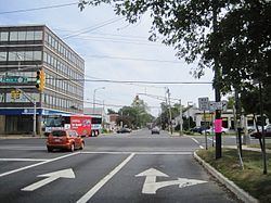
Several state routes also pass through, such as the freeway portion of Route 18 in the southwestern part, Route 35 and Route 36 in the center, and Route 71 in the north.
The Garden State Parkway is accessible just outside the borough in neighboring Tinton Falls at exit 105.
Public transportation
NJ Transit provides local bus transportation on the 831 and 832 routes.
Notable people
People who were born in, residents of, or otherwise closely associated with Eatontown include: