
Coat of arms Flag Rural localities 19 Founded 4 January 1926 | Urban-type settlements 2 Area 2,664 km² | |
 | ||
Administrative center | ||
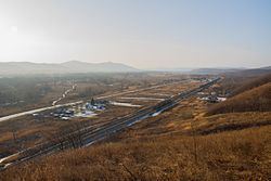
Shkotovsky District (Russian: Шко́товский райо́н) is an administrative and municipal district (raion), one of the twenty-two in Primorsky Krai, Russia. It is located in the south of the krai. The area of the district is 2,664.5 square kilometers (1,028.8 sq mi). Its administrative center is the urban locality (an urban-type settlement) of Smolyaninovo. Population: 24,511 (2010 Census); 25,809 (2002 Census); 111,460 (1989 Census). The population of Smolyaninovo accounts for 27.4% of the district's total population.
Contents
Map of Shkotovsky District, Primorskiy Kray, Russia
Etymology
The district is named for Nikolay Shkot, a war veteran of the Siege of Sevastopol.
References
Shkotovsky District Wikipedia(Text) CC BY-SA