Area 99.46 km² Local time Sunday 6:03 AM | Population 25,471 (1 Jan 2011) Flower Irises | |
 | ||
Time zone Japan Standard Time (UTC+9) City hall address 253-1 Ōaza Sakata, Shiroishi-chō, Kishima-gun, Saga-ken849-1292 Weather 6°C, Wind NW at 18 km/h, 90% Humidity | ||
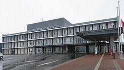
Shiroishi (白石町, Shiroishi-chō) is a town located in Kishima District, Saga Prefecture, Japan.
Contents
- Map of Shiroishi Kishima District Saga Prefecture Japan
- Geography
- Climate
- Adjoining Cities and Municipalities
- History
- Demographics
- Agriculture
- High Schools
- Junior High Schools
- Elementary Schools
- Air
- Rail
- Roads
- Festivals
- Notable Places
- References
Map of Shiroishi, Kishima District, Saga Prefecture, Japan
On January 1, 2005 Shiroshi absorbed the towns of Fukudomi and Ariake, all from Kishima District, to become the new and expanded town of Shiroshi.
Geography
85% of the total area of Shiroishi is farmland. The town borders the Ariake Sea on the southeast. Much of the land near the Ariake Sea is reclaimed.
Climate
Adjoining Cities and Municipalities
History
Demographics
27.01% of the population (7,437) are 65 or older. In 2005 there were 183 births and 322 deaths, 624 immigrants and 805 emigrants, indicating a negative population growth.
Agriculture
Shiroishi is a very agricultural community. Some of their agricultural products include tempe, renkon, strawberries, onions, rice, and beef.
High Schools
(prefectural)
Junior High Schools
Elementary Schools
Air
The closest airports are Saga Airport and Fukuoka Airport.
