
Population 114 (2011) Council seat Murchison Settlement Website Shire of Murchison Area 49,500 km² | President Mark Halleen State electorate(s) North West | |
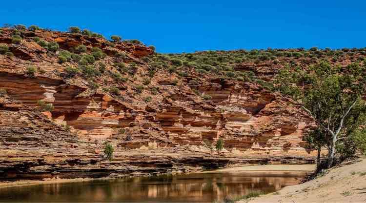 | ||
The Shire of Murchison covers a large area of the Murchison sub-region of the central part of Western Australia, 300 kilometres (186 mi) northeast of Geraldton. The shire and the older 'Murchison' region and goldfield are now part of the designated Mid West region.
Contents
Map of Murchison, WA, Australia
It is Australia's second least populated local government area and the only one without a town.
Description
The Shire of Murchison incorporates 29 pastoral stations and a population of 114. Most properties are operated by family units with their main income from cattle, meat sheep and wool, with some goats. A small tourism industry is developing in the region with some stations involved in station stays and with the Murchison Oasis Caravan Park and motel units located at the settlement providing facilities for tourists.
History
The Shire of Murchison takes its name from the Murchison River, which was named in 1839 by explorer George Grey after Sir Roderick Impey Murchison, President of the Royal Geographical Society of London. The Shire’s logo is based on the coat of arms of his family, Murchison of Tarradale (lion rampant between two pineapples with a scallop shell at the base).
The Murchison Road District was gazetted on 3 August 1875. It absorbed the Upper Murchison Road District on 18 March 1912. On 1 July 1961 it became the Shire of Murchison following changes to the Local Government Act.
A residence for the Shire Clerk was built in 1966 approximately 200 km north of Mullewa on the Carnarvon to Mullewa Road. This building included a shire office. In 1985 a roadhouse and new Shire offices that included a museum were built; this area was gazetted as the Murchison Settlement in 1988.
In 2004 the shire was expanded in area when the northern part of the Shire of Mullewa and an eastern section of the Shire of Northampton were incorporated into Murchison.
Wards
The shire is represented by 7 councillors, and has been divided into two wards. The shire president is elected from among the councillors.
Prior to 2005, there were 4 wards - Boolardy, Byro, Mileura and Yallalong.
Murchison Radio-astronomy Observatory
The Shire is the site of the Murchison Radio-astronomy Observatory. A sparse population - and its consequent radio "quietness" - is a factor behind the Shire being selected as one of the two sites for the Square Kilometre Array - a proposed array of radio telescope receivers with a total collecting area of one square kilometre. It is already home to two other major radio telescope facilities: the Murchison Widefield Array and the Australian Square Kilometre Array Pathfinder.
The Square Kilometre Array, or SKA, is a global radio telescope project involving institutions in more than 20 countries. The SKA will be the largest and most capable radio telescope ever constructed—50 times more sensitive than any other radio instrument. Australia and southern Africa will each host different components of the SKA. Management of the facilities at the SKA is coordinated by the CSIRO from the offices and laboratories at the Murchison Radio-astronomy Support Facility in Geraldton.