
Population 2,577 (2006 census) Area 4,321 km² | Established 1932 Founded 1932 | |
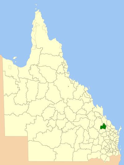 | ||
The Shire of Monto was a local government area in the northern catchment of the Burnett River, Queensland, Australia. The shire covered an area of 4,320.8 square kilometres (1,668.3 sq mi), and existed as a local government area from 1932 until 2008, when it amalgamated with several other shires to form the North Burnett Region.
Contents
History
The Monto district came into being as part of a Land Development Scheme for returning soldiers. The first town buildings were erected in 1926, followed by the Butter Factory in 1927. In July 1931 the railway was officially opened and on 3 March 1932, the Shire of Monto was proclaimed on land previously administered by the Shires of Eidsvold and Mundubbera. The town of Monto also briefly served as the administrative centre of Eidsvold.
On 15 March 2008, under the Local Government (Reform Implementation) Act 2007 passed by the Parliament of Queensland on 10 August 2007, the Shire of Monto merged with the Shires of Biggenden, Eidsvold, Gayndah, Mundubbera and Perry to form the North Burnett Region.
Towns and localities
The Shire of Monto included the following settlements: